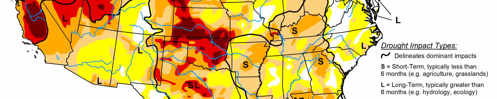
According to the U.S. Drought Monitor for Sept. 18 released Sept. 20, three tropical systems drenched three separate drought areas this past week, with Hurricane Florence affecting the Carolinas with record rainfall, a low pressure system in the western Gulf of Mexico bringing rain to parts of Texas and Louisiana, and Tropical Storm Olivia bringing yet more rain to Hawaii. Drought conditions improved or were alleviated across these regions. Some showers and thunderstorms were seen across the Plains, but not enough to improve drought conditions. Unfortunately, many areas experiencing severe to exceptional drought saw little to no rainfall, with the dryness often accompanied by warmer-than-normal temperatures for this time of year, exacerbating conditions. Notably, eastern Oregon, northern Utah, and western Colorado all saw expansion of extreme or exceptional drought.
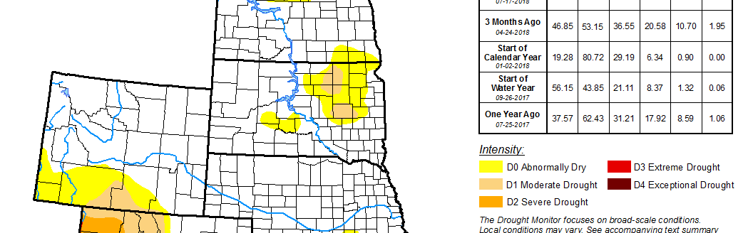
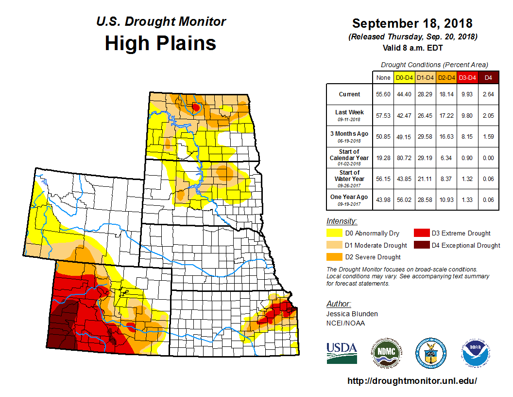
Dry conditions continued in northwestern North Dakota, where precipitation over the past two months has been less than 30 percent of normal. Moderate (D1) and severe (D2) drought were expanded westward in this area. In the southwest, D1 was expanded slightly in Hettinger County, where precipitation has been just 20 percent of normal for the same period. However, conditions were better to the east, and normal conditions returned to northern Brant and much of western Morton counties. In western South Dakota, an area of severe drought was introduced area in Haakon County. Local reports indicate that many crops have been cut for feed due to drought and winter wheat planting is starting out dry. The fields left standing have low expected yields. Moderate drought was expanded where rainfall has been less than 25 percent of normal over the past two months. Additionally, both moderate and severe drought were expanded in north central and northeastern part of the state. Impacts here include early chopping of corn for silage instead of growing for grain harvest, low corn and soybean yields and test weights, and early harvest due to drought. Abnormal dryness and moderate drought were also expanded in central South Dakota. Pierre has received less than 25 percent of its average rainfall over the past two months. With little to no rain and temperatures reaching into the upper 80s, drought conditions deteriorated toward the south/southwest in eastern Kansas. Conversely, the small patch of D0 from west central Kansas farther west into eastern Colorado improved to normal, where rainfall has been average to above average over the past 1 to 3 months. In east central Colorado, D1 was extended into northern Elbert County, where virtually all crops in this county were rated very poor this year. Additionally, D0 was expanded slightly eastward in southern Wyoming and eastern Colorado. Exceptional drought (D4) was added to southeast and central Mesa County, and Delta County in western Colorado. Record low snowpack this winter and near-record high evaporative demand this summer have led to rapidly depleting water supplies. Moderate drought was expanded to central Sweetwater County, Wyoming, where hot, dry conditions have prevailed through much of the warm season and precipitation for the water-year-to-date is below normal. No changes were made this week to the depictions in Nebraska as agricultural conditions in the state are good as the season ends and maturation is ahead of schedule.