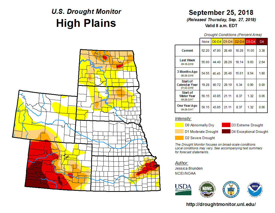
According to U.S. Drought Monitor for Sept. 25 released Sept. 27, the combination of energetics from northern Mexico lifting toward the Southern Rockies/Great Plains and enhanced moisture from the remains of a tropical depression led to heavy precipitation events across the south-central U.S., particularly notable as a frontal zone stalled. Significant rain fell across much of the South, leading to much improved drought conditions in many areas. In fact, several regions across the U.S. received at least double (or more) of their typical precipitation for this time of the year over the past week, including the far Pacific Northwest, eastern Montana to northern Nebraska and Iowa and western Wisconsin, southwestern Arizona into northwestern New Mexico, and a large swath encompassing much of Texas northeastward to southern New Hampshire, part of which was from the remnants of Florence, now classified as the second wettest storm of the past half century to impact the U.S. Parts of the Southeast and most of the West were dry and drought conditions spread or worsened in several regions.
As summer comes to a close and fall begins, many areas across the High Plains continue to experience dry conditions. In eastern Kansas, extreme drought (D3) was extended into the northern half of Osage County as well as southwestward into northeastern Marion County. Extreme drought was also introduced in Eddy County in east central North Dakota, with adjoining extreme (D2) and moderate (D1) drought each extending slightly farther south to southern Foster County. These counties have each received less than 25 percent of their typical precipitation over the past two months. Among some of the local observances: “Soybean yields are disappointing. Corn harvest has started, more than a month earlier than normal. Grasshoppers are thick in some areas of the county, damaging some late season crops. Some producers have started feeding their cattle, which typically does not happen until first snowfall. Pastures are bare and water sources have dried up. Producer are having to haul cattle home from pastures”. In northern Wyoming, a small patch of D0 was introduced to northern Campbell County, and a larger swath was introduced just to the south from Johnson County (Wyoming) east to Shannon County (South Dakota). These areas have also seen below-average precipitation over the past two months, with Mt Rushmore the fifth driest in its record for this period.


