According to the U.S. Drought Monitor for Oct. 2 released Oct. 4, multiple cold fronts, associated with an amplified upper-level trough, resulted in heavy rainfall across the eastern third of the continental U.S. during the final week of September. A widespread area of 2 to 4 inches, locally to 10 inches, was observed from the Tennessee Valley northeast to southern New England. A strong subtropical ridge maintained below normal precipitation and above normal temperatures (6 to 8 degrees F) across the Coastal Plain of Georgia south to the Atlantic coastal areas of Florida during the past week. A pair of strong surface highs shifted south from Canada into the north-central U.S. where below-normal temperatures were observed at the end of September through the beginning of October. Hurricane Rosa, in the East Pacific, turned northeast and made landfall as a tropical depression in the northern Baja Peninsula at the beginning of October. Heavy rainfall associated with Rosa spread northward from northwestern Mexico and triggered flash flooding across southern Arizona during Oct. 1 to 2.
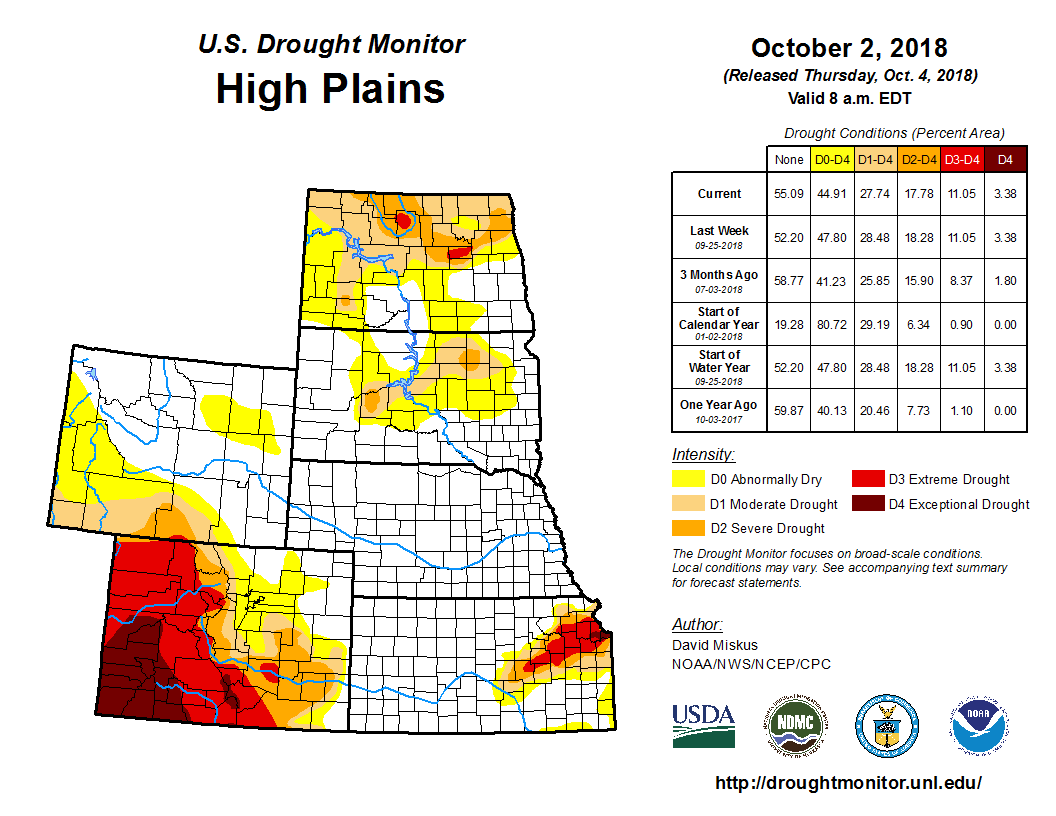
Light precipitation (0.5-1 inch) and 7-day temperatures averaging 5 to 10 degrees F below normal was enough to provide some improvements to the drought across the Dakotas as autumn is an ideal time of year for soil moisture recharge due to the lack of evaporation and minimal plant growth. Based upon a combination of various tools, the cool, wet weather warranted improvement in northwestern and southwestern ND and northeastern SD (D2 to D1), central SD (D1 to D0), and east-central and south-central ND, north-central and southwestern SD, and northeastern WY (D0 to nothing). Elsewhere, the light precipitation and subnormal temperatures were enough to keep conditions from deteriorating, but not wet enough for any improvement. Although it has been dry for the past 60 days in western Nebraska and northwestern Kansas, the cool weather delayed the introduction of D0 for now, but rain will be needed soon to prevent deterioration. In addition, D0 was expanded into southeastern Kansas with respect to the large Midwestern drought area as 30-day deficits had accumulated there.


