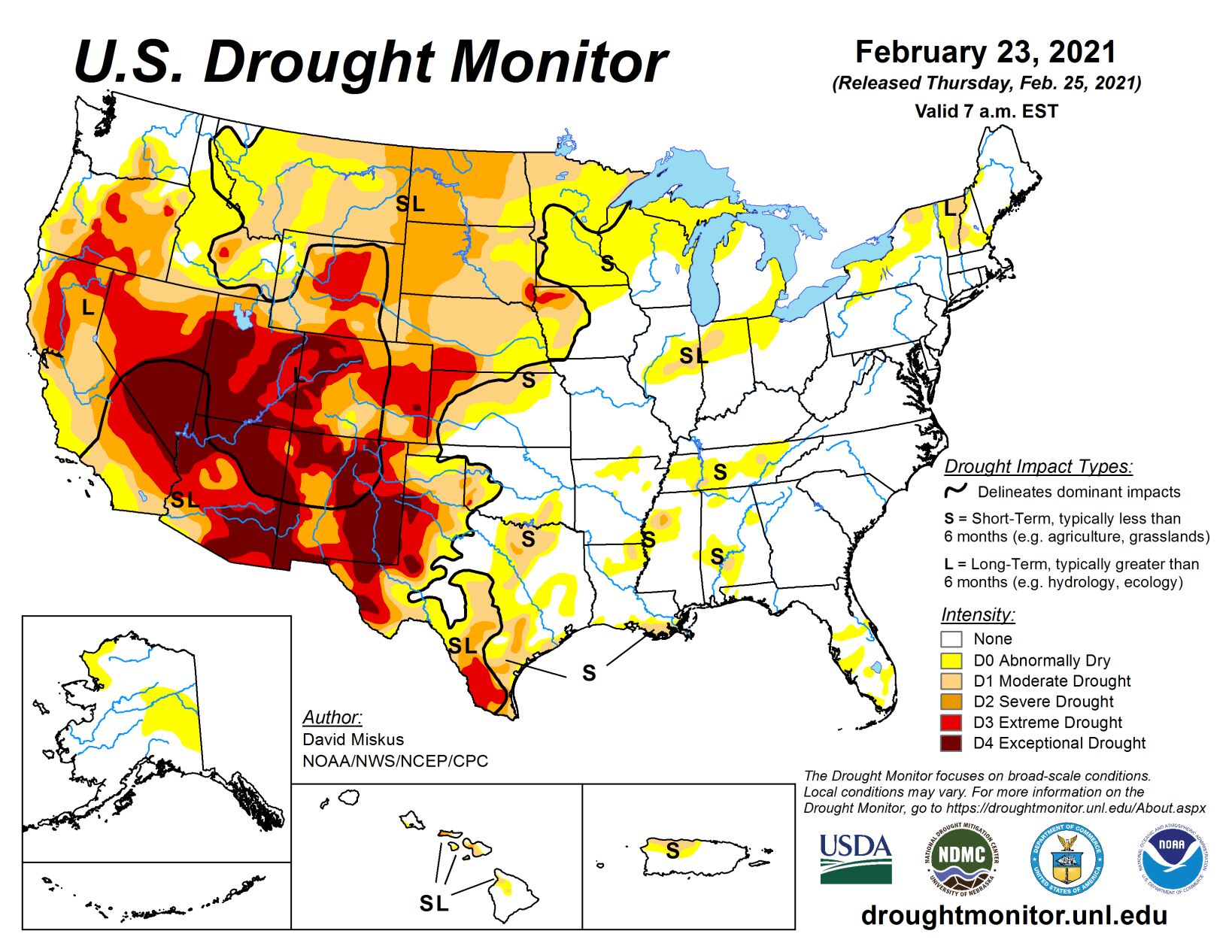
After a frigid start to the period, especially throughout the middle third of the nation where daily temperature anomalies were 30 to 40 degrees F below normal and readings dropped below -40 degrees F in Minnesota and 0 degrees F as far south as central Texas, temperatures finally moderated by week’s end. By Feb. 22, highs had risen into the 40s and 50s degrees F in the Dakotas and 70s and 80s degrees F in Texas.
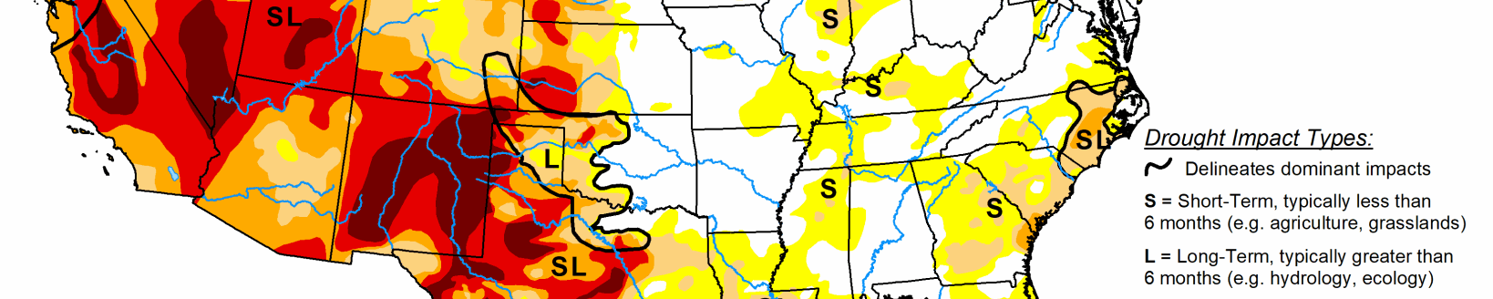
Frequent Pacific storms battered the Northwest, and then tracked southeastward across the Northern and Central Rockies, dropping plentiful moisture on Washington, Oregon, northern California, Idaho, & western Montana, but missing most of the Southwest yet again. Storms also dropped widespread precipitation on much of the Southeast, mid-Atlantic, and coastal New England while most of the Midwest saw light frozen (snow, sleet, freezing rain) precipitation.
Dry weather was observed across much of the Plains except in south-central Texas. Weekly temperatures averaged below to much-below normal throughout the lower 48 States except for central and southern Florida.
High Plains
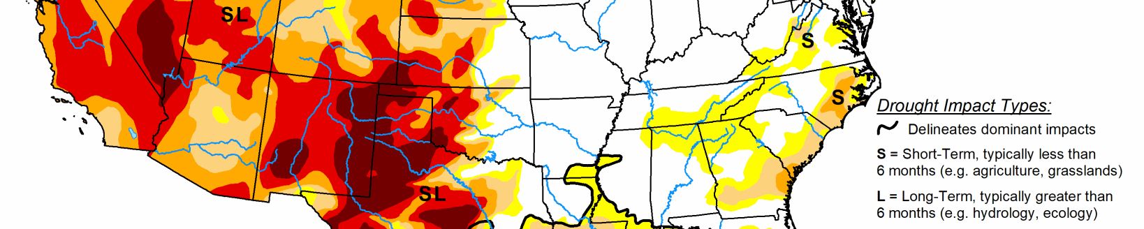
After several weeks of light to moderate snow events in the Central Plains, drier (but still frigid conditions, although moderating by week’s end) weather returned to the region. With the recent improvements in the Central Plains and subnormal temperatures, no changes were made there. Farther north, however, even though precipitation is normally low during the fall and winter seasons, it has been extremely dry during the past 3-4 months (less than 25% of normal), leading to a lack of any snow cover in eastern Montana, western North Dakota, and north-central South Dakota. Short-term indices (1-, 2-, 3-, 4-, and 6-months) were at D3 and D4 levels, thus D2 was expanded southward across south-central North Dakota and central South Dakota, and D1 added in north-central South Dakota. In contrast, additional precipitation in Wyoming and Colorado boosted mountain snow water equivalent (SWE) as of Feb. 23 at or closer to normal, thus some improvements were made across southern and southeastern Wyoming and in parts of north-central and south-central Colorado. A few areas in Wyoming had missed out on the recent snows, so some slight degrading was made to those areas.
South
Little or no precipitation fell on the Southern Plains except across south-central Texas, improving conditions there, while light to moderate amounts (0.5-2 inches) were measured in the lower Mississippi Valley (Louisiana, Arkansas, Mississippi, Tennessee). Where enough precipitation fell to make a significant dent in the short-term deficiencies, a 1-cat improvement occurred (e.g. northern and eastern Mississippi, southern Tennessee). However, the greatest rains seemed to fall on non-drought areas. In contrast, little or no precipitation fell on south Texas and northeastern Texas into southeastern Oklahoma, expanding drought severity and area there. USGS 7-day average stream flows have dropped into the below to much-below normal levels
Midwest
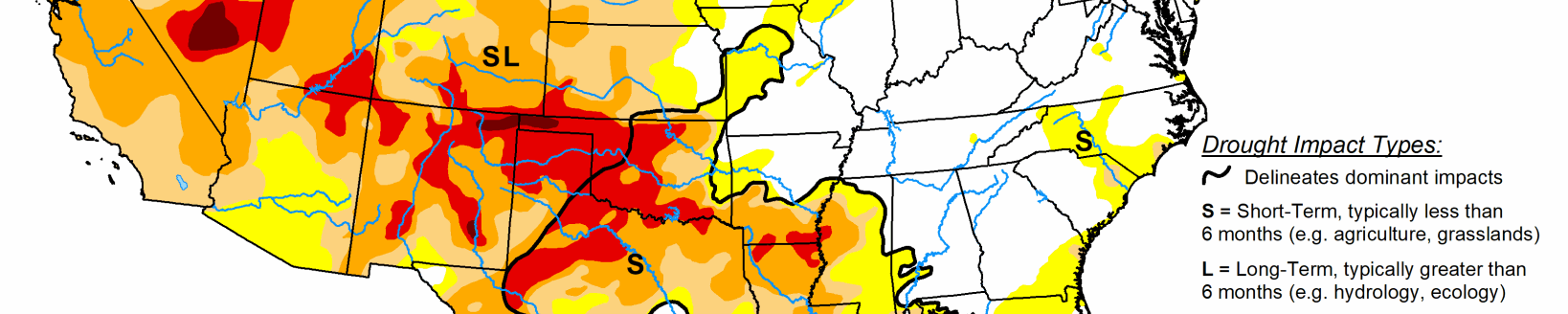
Much less precipitation (0.1-0.25 inches) fell across most of the Midwest as compared to the previous week, although a few areas received more than 0.5 inches liquid equivalence. With weekly temperatures well below normal (temperature anomalies -10 to -20 degrees F), sub-zero readings of -10 to -30 degrees F, a light snow cover from Minnesota and Iowa eastward to Ohio, and dormant agricultural conditions, status-quo was the best choice. However, parts of eastern Nebraska & western Iowa saw wet snow (2-10 inches) over the weekend, and with several recent snowstorms in this area, some slight improvements were made in western Iowa as short-term indices were wet out to 4-months, near-normal at 6-months, but still droughty (D2-D4) at 9- and 12-months. Hopefully most of the moisture from the snow will infiltrate into the soils, but as mentioned last week, this is not guaranteed.
West
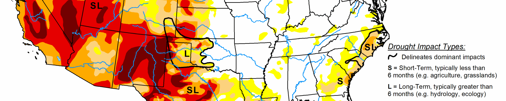
Ample Pacific moisture and storms dropped decent amounts of precipitation on the Northwest, especially Washington, Oregon, northern California, Idaho, western Montana, and western Wyoming, with lesser amounts across northern Nevada, central Utah, northern and southern Colorado, and parts of New Mexico. The active Pacific storm track continued to benefit Washington, Oregon, and northern California, along with most northern and central mountains in the West. February 23 basin average SWEs continued to increase toward normal, with most basins in Washington, Oregon, Idaho, western Montana, and northwestern Wyoming at or above normal SWE. Accordingly, some slight improvements were made where recent surplus precipitation fell and the basins had SWEs exceeding 100%. With improvements made last week in northern Nevada and central Utah, and these areas still impacted from the failed Southwest summer monsoon, no changes were made this week, although the basin SWEs were up to 70-80% of normal as of Feb. 23. The light precipitation in New Mexico and eastern Arizona was not enough for any improvements this week. In California’s Sierra Nevada, the Feb. 23 SWE stood at: North – 67%; Central – 72%; South – 50%; statewide summary – 65%. In contrast, central Nevada missed out on the recent storms, and with the failed summer monsoon, conditions have gotten worse, thus D4 was expanded to include central Nevada. In addition, the Impact Lines were adjusted to show that more of the drought in the West was long-term (L) since recent storminess had pushed the short-term indices into various wet categories, although the much drier in the short-term Southwest remained in SL.