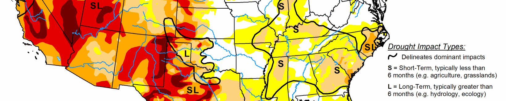
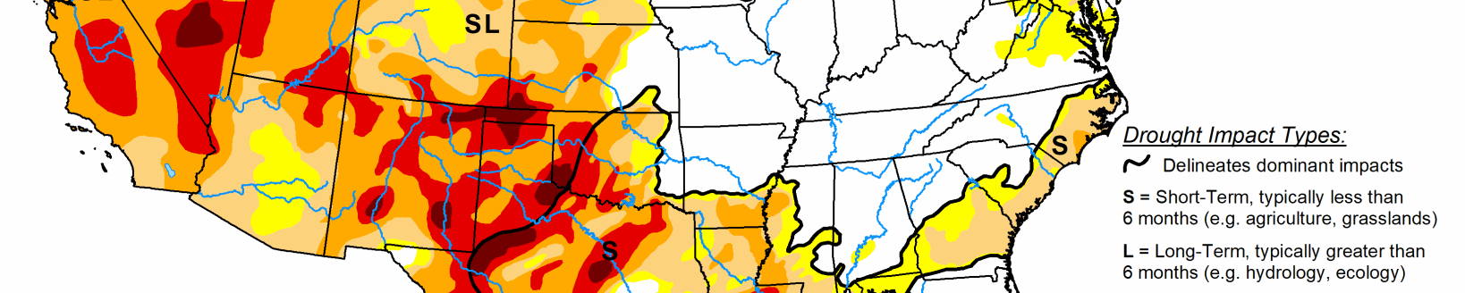
Low-pressure system brings rain to southern areas
A low-pressure system propagated eastward across much of the southern tier states early in the period (March 4-6) and merged with a short-wave trough dropping southeastward from the Midwest before moving off the Mid-Atlantic coast on March 7. This system dropped more than 2 inches of rainfall over large areas from extreme southeastern New Mexico eastward to South Carolina.
Some areas of central Alabama and Georgia saw more than 5 inches of rainfall, which fell over saturated soil. However, much of the heavier rainfall remained north of the I-10 corridor from southern Texas to northern Florida, while areas south of I-10 received only modest amounts, which were not nearly enough to reduce deficits. The Pacific Northwest and California also saw some precipitation over the past week, but amounts were not enough to reduce any deficits. Some recent dryness over southern Iowa and northern Missouri was mitigated a bit with near- to above-normal precipitation falling last week as well. Deficits increased in the Mid-Atlantic and New England over the past 30 days, but were kept at bay, as these areas saw 0.1 to 1 inch and 0.1 to 0.5 inches of rainfall, respectively. The active storm track continued last week for Alaska, with the southeastern Panhandle receiving 2 to 6 inches of precipitation over many areas. This precipitation, along with near- to below-normal temperatures, has finally produced above-normal snowpack in the Alaska Panhandle for the first time in 7 to 8 years, warranting D0 removal. Hawaii remained dry on the leeward slopes last week due to persistent trade winds, leading to some D0 expansion and development on the Big Island and Oahu, respectively. Puerto Rico saw D0 removal, as northern portions of the island saw much above-normal precipitation, eliminating short-term deficits.
South
D0 was expanded northward from the Gulf Coast of Louisiana, Mississippi, and Alabama. Many of these areas have 6-month deficits of over 8 inches; 6-month deficits over 12 inches in southeastern LA (i.e. 50 to 75 percent of normal). Rainfall over the past 30 days has been particularly low, with precipitation falling to 25 to 50 percent of normal, with some locations in the new D1 area seeing 10 to 25 percent of normal. Some expansion of D1 was made northeast of Corpus Christi, Texas, and D2 toward the coast, as USGS stream flows were well below normal at many locations and soil moisture has diminished further in recent weeks. Meanwhile, many areas in western and northern Texas (north of the I-10 corridor) saw anywhere from 0.5 to 3 inches (in isolated locations). The heavier rainfall extended southward into the upper Rio Grande Valley where many areas saw 0.25 to 1 inch of rainfall, warranted some reduction in D0, D1, and D2 areas along the river. It is status quo elsewhere for the Southern Region, including southwestern Oklahoma, whose 7-day totals (0.25 to 1 inch) were not enough to cut into rainfall deficits.
Midwest
Southern Iowa and northern Missouri have seen drier-than-normal conditions over the past 30 days. However, this has been welcomed dryness as long-term surpluses are widespread across the Midwest. There were a few reports of good soil conditions and some isolated field work in southwestern Iowa. In addition, sub-soil conditions continued to be wetter than normal for much of the Midwest Region and USGS average stream flows were near and above normal for the entirety of the region. As such, no D0 development was required.
High Plains
D1 was expanded a bit in northeastern Colorado (i.e., existing D1 areas were connected). This area has continued to experience warmer-than-average temperatures in recent weeks, which has had adverse effects on winter wheat and rangelands prior to green-up. In addition to SPIs showing D1 (and worse over longer periods at a couple locations), USGS stream flows in surrounding locations were showing flows below the 10th percentile. Some drier-than-normal conditions crept into eastern portions of the Dakotas over the past 30 days (25 to 50 percent of normal precipitation, with some small areas of 10 to 25 percent of normal in extreme eastern South Dakota). However, 60- and 90-day precipitation was near and above normal, respectively, for these areas. Therefore, it was status quo for the rest of the High Plains Region.