Drought worsens in Oklahoma Panhandle and south Texas; blowing dust and crop failures reported
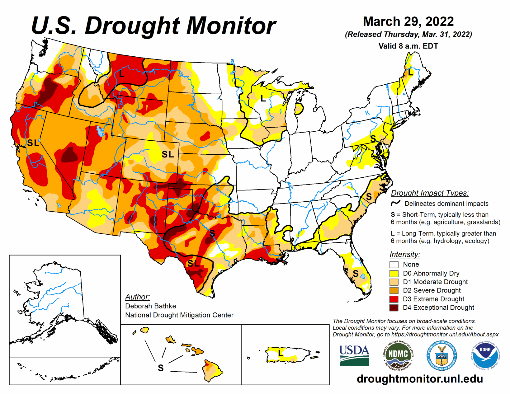
Two fast-moving storms impacted the Lower 48 last week. Heavy rain fell across parts of the Midwest and South, leading to broad areas of drought improvement in these regions. Parts of the West saw much-needed rainfall. In most cases, these amounts were not enough to bring relief to the region’s relentless long-term drought conditions. Pockets of dryness also continued across the northern High Plains, South, and Southeast leading to drought expansion.
South
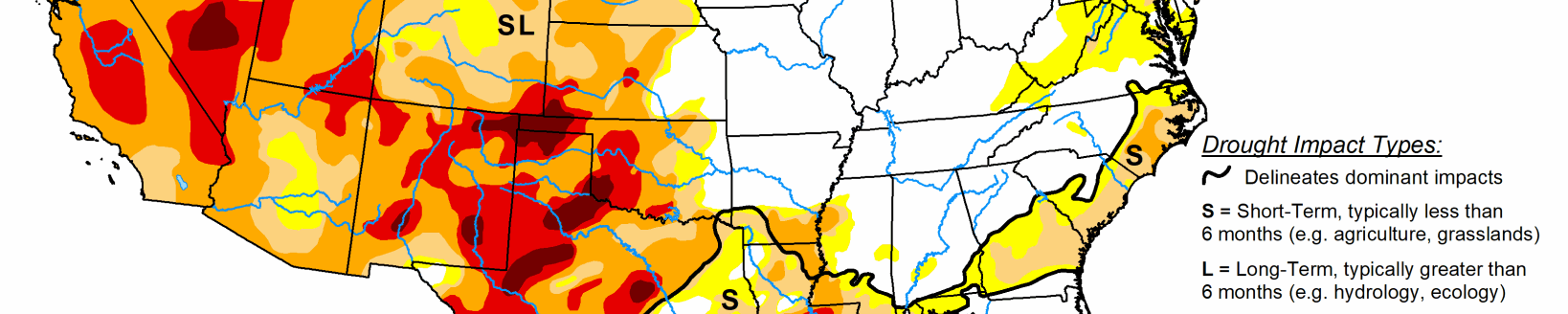
This week the South saw drought worsen across west and south Texas and the Oklahoma Panhandle. Above-normal temperatures combined with below-normal precipitation and high winds exacerbated conditions. Drought indicators supporting the degradations include increasing precipitation deficits, dry surface and root zone soil moisture and low stream flow. State drought teams noted reports of blowing dust and crop failures in the area. One-category improvements were made to drought conditions across east Texas, southern Arkansas, north and central Louisiana and Mississippi in areas where the heaviest rain (3 inches or more) fell and where warranted by short-term precipitation indicators, streamflow, soil moisture and other measures.
Midwest
Above-normal precipitation combined with below temperatures led to improvements across much of the Midwest this week. Until recently, the region hadn’t had enough precipitation to warrant improvements to deficits that had been building since spring last year. Now, virtually all short-term drought has been eliminated. This is denoted by the removal of the S designation on the map. Long-term drought remains where precipitation deficits of 6 months or longer exist and where deeper soil moisture and groundwater indicators have yet to recover.
High Plains
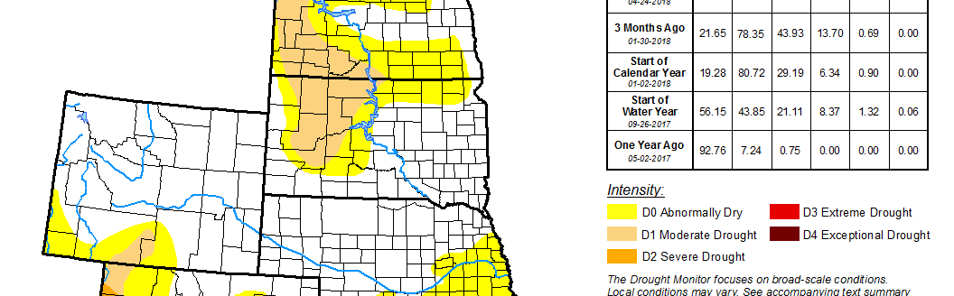
Much of the High Plains remained dry last week resulting in deteriorating drought conditions across parts of the Dakotas and Nebraska. The eastern edges of abnormal dryness (D0) and moderate drought (D1) crept eastward. Severe drought (D2) expanded over a large swath from southwest North Dakota to central Nebraska. Extreme drought spread in central Nebraska. Short-term dryness is superimposed over long-term moisture deficits across the region. The lack of seasonal snow cover combined with the onset of spring has people in the region worried. Soil moisture is very low, stream flows continue to decline and state reports indicate that stock ponds are drying up.
West
Parts of the West saw much needed precipitation with rain over the West Coast and higher elevation snow over the Sierra Nevada Mountains. In most cases, these amounts were not enough to bring relief to drought conditions that have plagued the region for months. Only western Oregon saw minor improvements to abnormal dryness (D0) and moderate drought (D1) in response to recent precipitation.
Across much of the West, higher than normal temperatures last week caused premature snow melt, with snowpack values plummeting over just a few days. The California Department of Water Resources noted that about one-third of the water equivalency disappeared in a week. Extreme drought (D3) expanded in northern California, parts of Utah, and New Mexico. In these locations, the warm weather has led to increased evaporative demand and stress on vegetation. The rest of the West remained unchanged this week.
Related Articles