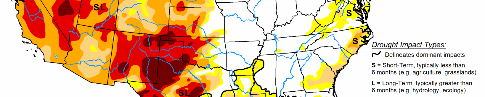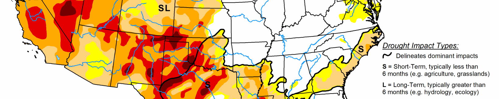
This U.S. Drought Monitor for Nov. 6 released Nov. 8 saw improvements on the map across portions of the Pacific Northwest as well as in the northern and central Rockies, where scattered rain and mountain snow showers helped to boost snowpack levels and improve soil moisture content. In California and the western Great Basin, the dry pattern has continued from the summer months with no relief expected in the coming weeks in terms of precipitation. In northwestern California, the combination of long- and short-term precipitation deficits, agricultural impacts and poor surface water flows led to further degradation of conditions. Conversely, in the desert region of southeastern California, areas of severe and extreme drought improved in response to well- above-normal precipitation levels during the past 60 days in association with residual moisture from two tropical storm events that impacted the Southwest. Across the lower Midwest and Northeast, beneficial rains this week helped to reduce short-term precipitation deficits and improve soil moisture.
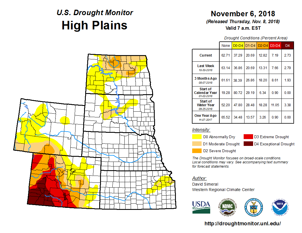
On this week’s map for the High Plains, improvements were made in areas of Abnormally Dry (D0) and Moderate Drought (D1) in eastern Montana where precipitation during the past 60-day period has been above normal and soil moisture conditions have improved considerably. Elsewhere in the region, no changes were made on the map. In the Missouri River Basin system, above-average releases are expected to continue through November, according to the U.S Army Corps of Engineers. For the week, the region experienced near-to-below-normal temperatures with the largest negative anomalies (2 to 8 degrees below normal) in eastern Colorado and Wyoming.
Locally heavy rains impacted the southern portion of the Midwest region with the largest accumulations (4-to-6 inches) observed across the Ohio Valley. In Missouri, 2 to 4 inches of rain this week led to removal of the remaining area of Moderate Drought (D1) and reduction in areas of Abnormally Dry (D0) across the state. For the week, average temperatures hovered within a few degrees of normal across most of the region with the exception of areas in the Ohio Valley where temperatures were 3 to 6 degrees above normal. For the past 90-day period, precipitation has been above normal across a large portion of the region.