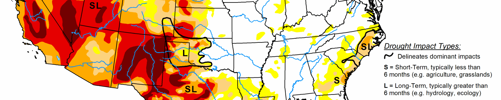
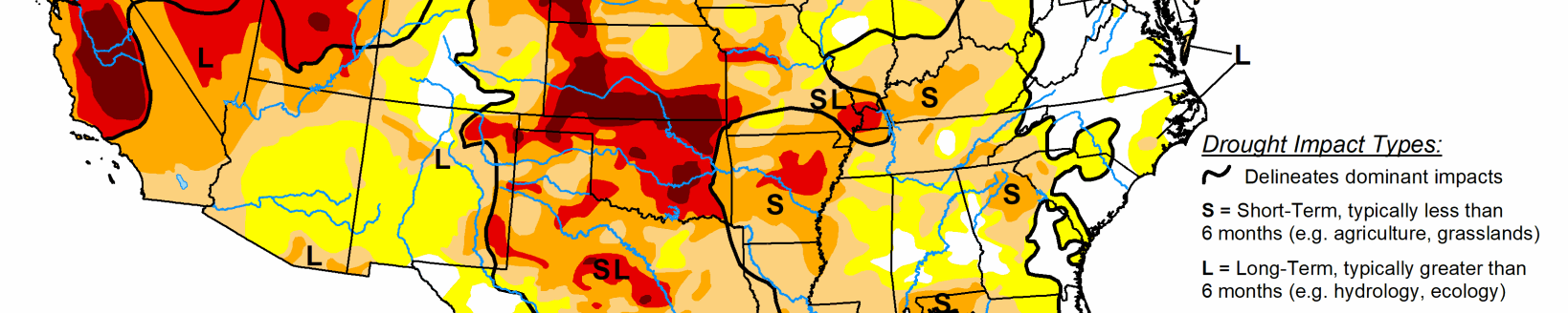
Extreme drought expands across SE Colorado; drought intensifies in Oklahoma and Kansas
A strong upper-level ridge developed over the Southwest at the beginning of June and expanded east to the southern Great Plains. Seven-day temperatures (June 2 to 8) averaged more than 10 degrees F above normal across much of the southern to central Great Plains until a strong cold front arrived on June 9. From June 6 to 8, a vigorous upper-level trough progressed east and resulted in varying amounts of rainfall and much cooler temperatures from the Pacific Northwest to the northern Rockies and northern Great Plains. Around the periphery of the upper-level ridge, mesoscale convective systems with severe thunderstorms and locally heavy rain (more than 2 inches) occurred from the Upper and Middle Mississippi Valley southeast to the mid-Atlantic. After spending multiple days stationary over southern Mexico, Tropical Storm Cristobal tracked north across the Gulf of Mexico and made landfall in southeast Louisiana on June 7. The heaviest rainfall occurred to the east of its landfall. 7-day precipitation amounts (ending 12Z June 9) exceeded 5 inches, with locally higher amounts, from the Mississippi Gulf Coast east to the Florida Panhandle.
South
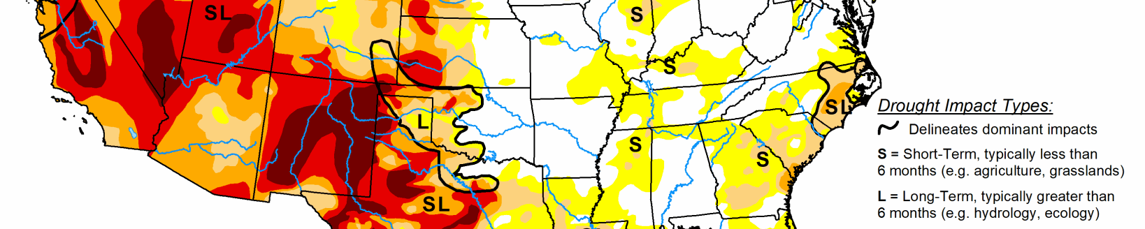
Drought continues to rapidly develop and intensify across the southern Great Plains. During a relatively wet time of year, precipitation has averaged less than 50 percent across much of western Oklahoma and the Texas Panhandle. This lack of rainfall coupled with periods of much above normal temperatures and strong winds have dried out topsoils quickly. According to the USDA’s National Agricultural Statistics Service, topsoil moisture being rated as short or very short across Oklahoma increased from 23 to 53 percent during the past week. Conversely, 1 to 2-category improvements were made along the Gulf Coast. Total rainfall amounts, associated with Tropical Storm Cristobal, included 8 inches at Pascagoula, Mississippi. Moderate long-term drought remains designated for the Mississippi Gulf Coast due to precipitation deficits dating back to 90 and 180 days.
Midwest
The Corn Belt remains drought-free due to long-term precipitation surpluses along with favorable soil moisture at depth. As of 12Z on June 9, short-term deficits and drying topsoils supported the addition of a small area of D0 in the northwest corner of Iowa. This region will be reassessed next week since heavy rain fell after the valid time for this week’s USDM. Southeast Illinois and western Kentucky are beginning to dry out. Since 28-day streamflows and soil moisture remain above the 40th percentile, abnormal dryness (D0) was not added this week to southeast Illinois or western Kentucky. Heavy rain (1 to 5 inches) resulted in a 1-category improvement across northwest Minnesota, while moderate drought (D1) was expanded slightly south and east.
High Plains
Extreme drought (D3) was expanded across southeast Colorado based in part on soil moisture in the lowest 5th percentile. Above normal temperatures coupled with periods of strong winds continue to result in rapidly worsening conditions and reports of widespread selling of cattle. Trinidad, Colorado, recorded only 1.66" of precipitation year-to-date, which is the driest Jan. 1 to June 9 on record. Data here dates back to 1948.
The intensifying and developing drought conditions across Oklahoma also extended into the southern two-thirds of Kansas. This region missed out the widespread rainfall farther to the north across Nebraska and much above normal temperatures prevailed during the first week of June. Following the previous week’s expansion of abnormal dryness to cover a majority of Wyoming, moderate short-term drought (D1) was added to parts of Wyoming where the largest 60 to 90-day precipitation deficits along with SPI values support it. Widespread 7-day amounts of 1 or more inches of rainfall precluded additional expansion of abnormal dryness (D0) across much of the northern Great Plains, while there was a slight reduction of D0 across western Nebraska based on 7-day rainfall amounts.
West
Drought is rapidly developing or intensifying across northern and eastern New Mexico. Abnormal dryness was introduced to southeast Arizona based on SPI values. In addition, May 2020 was the 5th warmest May on record which is likely exacerbating the dyrness as a number of wildfires have developed. Abnormal dryness (D0) and moderate drought (D1) was expanded across southwest Utah, while the addition of extreme drought (D3) to Utah was supported by SPI values at various time scales. Farther to the north across Montana, widespread precipitation precluded a large expansion of abnormal dryness except for areas bordering Canada.
Unseasonably heavy precipitation, including high-elevation snow, prompted a slight decrease in the coverage of severe drought (D2) across parts of northeastern Utah. This decrease occurred where more than 1 inch (liquid equivalent) was observed. Likewise, 7-day precipitation (more than 1 inch) along with a wet late spring resulted in a slight decrease in extreme drought (D3) across northern California and severe drought (D2) in the southwest corner of Washington. Above normal precipitation during May into the beginning of June along with an increase in 28-day streamflows prompted slight improvements, while conditions worsened east of the Cascades. An increase in soil moisture and easing of long-term precipitation deficits resulted in a small 1-category improvement to the drought status across northeast Washington.