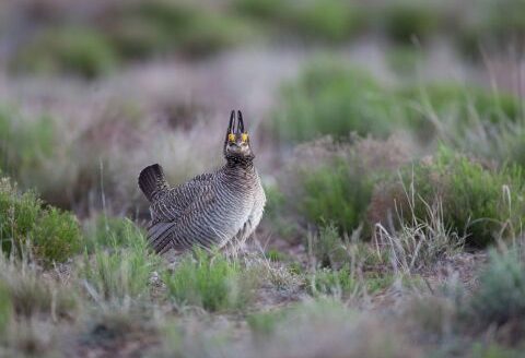
Lesser prairie-chicken aerial surveys to document population trends
Aerial surveys will begin March 16 and run through mid-May in five states containing lesser prairie-chicken habitat. The surveys are conducted annually by the Western Association of Fish and Wildlife Agencies to document population trends and how the bird is responding to management strategies identified in the Lesser Prairie-Chicken Range-wide Conservation Plan.
The range-wide plan is a collaborative effort of WAFWA and the state wildlife agencies of Texas, New Mexico, Oklahoma, Kansas and Colorado. It was developed to ensure conservation of the lesser prairie-chicken with voluntary cooperation of landowners and industry. The plan allows agriculture producers and industry to continue operations while reducing impacts to the bird and its grassland habitat.
“This survey is critical to provide annual estimates of the lesser prairie-chicken population across the five states,” explained Roger Wolfe, WAFWA’s lesser prairie-chicken program manager. “These population estimates help guide decisions related to conservation efforts targeting lesser prairie-chickens and their habitat.”
The surveys will be conducted by helicopter in locations chosen randomly within lesser prairie-chicken range, which is part of the methodology strategy. In previous years, some of the fly paths prompted calls, which is why WAFWA is providing notification about the start of aerial survey work.
Preliminary results from this year’s surveys will be available on July 1.