According to the U.S. Drought Monitor for March 20 released March 22, moderate precipitation fell in a wide swath covering an area from Kansas and Nebraska, eastward into parts of the Midwest and Mid-Atlantic regions. Additionally, moderate precipitation fell in the South and Southeast. Locally higher amounts fell in northern Florida late in the USDM period. Moisture laden systems continued to provide much needed precipitation to coastal California and the Sierra. Light to moderate precipitation fell in the Northeast, High Plains, and parts of the Rockies. The drought stricken areas of the Four Corners and the Southern Plains saw little to no precipitation.
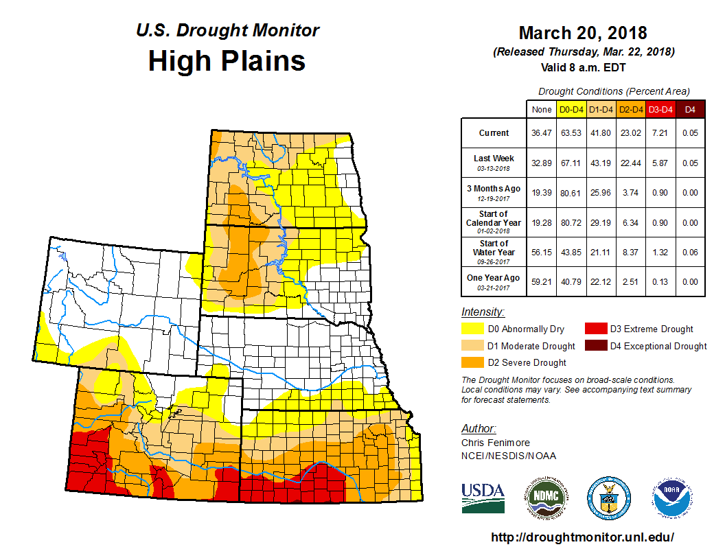
In the High Plains, precipitation was a mixture of above and below normal across the region during the USDM period. Precipitation surpluses of 0.25 to 1 inch were widespread across much of the western Dakotas, eastern Wyoming, much of Nebraska, the northeastern corner of Colorado and parts of western Kansas. The eastern Dakotas, north central Wyoming and much of southern Colorado had precipitation deficits of 0.25 inch during the period. Winter wheat conditions were rated 55 percent poor to very poor in Kansas where 60-day precipitation departures are as much as 3 inches below normal. Recent precipitation allowed for D0 to be removed in northern Nebraska and parts of western Minnesota. Moderate drought (D1) was trimmed back in central North Dakota. Extreme drought (D3) was expanded in southern Colorado.
—Chris Fenimore, NOAA/NESDIS/NCEI


