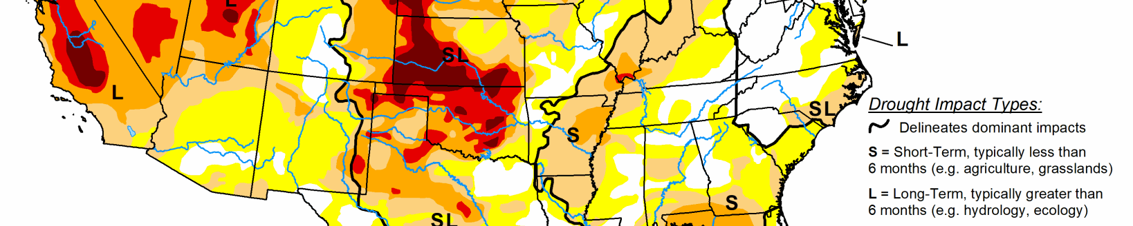
According to the May 29 U.S. Drought Monitor released May 31, hot weather (daytime high temperatures in the 90s) stretched from Arizona eastward to Louisiana early in the drought week, before spreading rapidly northward over the Great Plains and much of the Mississippi Valley. Some locations reported triple-digit heat during the week, associated with an amplifying ridge in the middle troposphere over the central contiguous U.S. Though the observed weekly precipitation pattern was largely convective in nature, both AHPS and ACIS depict the heavier precipitation amounts (over an inch) generally across the Southeast, the central Gulf Coast area, and the northern and central High Plains. These areas of heavier rainfall were associated with Subtropical Storm Alberto and baroclinic activity. Alberto developed early in the drought week over the western Caribbean Sea and tracked north over the eastern Gulf of Mexico. By early Monday evening (May 28, Memorial Day), the center of Alberto crossed the Florida panhandle near Panama City. Preliminary wind reports indicated 40 mph sustained winds at Panama City, with a gust to 59 mph. Near and along Alberto’s path northward, rainfall amounts of 3 to 8 inches were generally received, with locally heavier amounts.
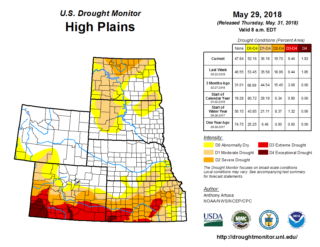
In south-central and southeastern Nebraska, recent triple-digit heat and dryness has been an issue, especially for pastures and alfalfa. Where 90-day SPIs were less than -1.5, moderate drought (D1) was introduced. This included a small area south of Omaha, which was linked to the D1 area in nearby Iowa. Moderate drought (D1) was also expanded across northern Fillmore and northwest Saline counties. Incidentally, Omaha matched or set four days of high temperature records during the long Memorial Day weekend (Friday through Monday). The highs ranged between 97 and 101 degrees F. Across northwest Kansas, widespread heavy rain (3 inches or greater, with some isolated CoCoRaHS totals of about 9 inches) warranted a one-category improvement in the depiction. Next week, once the rainwater has a chance to either percolate into the soil or run off into streams, additional alteration of the Kansas depiction may be needed. Across the Dakotas, D0, D1, and D2 categorical areas were generally expanded in coverage, due mostly to recent precipitation deficits. There was one area of improvement (D0 was removed) in the Black Hills of South Dakota due to rainfall this past week.