Early in the drought week, moderate precipitation fell along the East Coast with the heaviest rains falling in the eastern Carolinas and central Pennsylvania. Much-needed rains fell in a swath of area covering eastern Wyoming, much of Nebraska, Kansas and Oklahoma, eastern Colorado and the majority of New Mexico. The northern Plains, Midwest and South saw lighter precipitation amounts. Central and south Texas saw little to no precipitation during the week while the dry pattern continued for much of the West. For the month of July, preliminary statewide temperature data suggest much of the U.S. was warmer than average. The West, Southwest, South, and Northeast were among the warmest third of historical records which date back 124 years. Total precipitation amounts for the month of July were below average for much of the Midwest and Northwest. Also during the month of July, above average precipitation fell in the Mid-Atlantic States to Northeast, Southwest and parts of the High Plains.
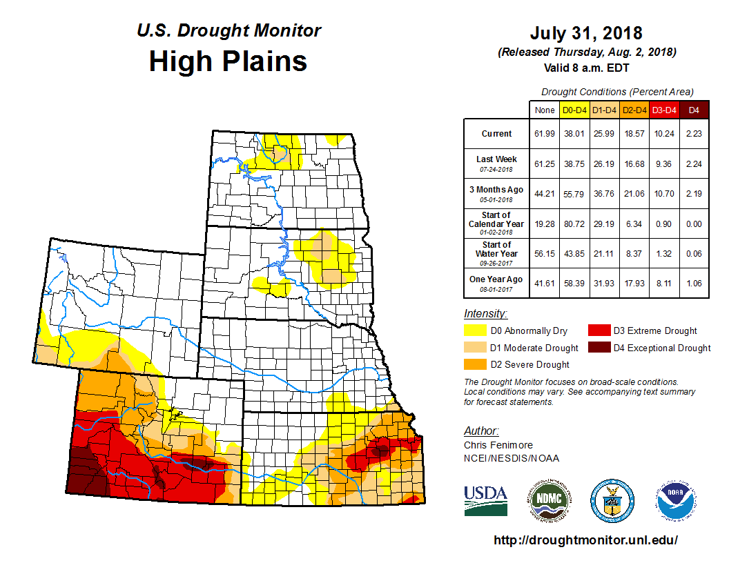
A swath of light to moderate precipitation fell in an area roughly covering north and east Wyoming, east Colorado and much of Nebraska and Kansas. The heaviest precipitation fell in western Nebraska, Kansas and eastern Colorado where amounts of 2 inches were widespread. Despite the rains, long-term drought was hardly affected. There was a slight improvement in southeast Colorado, and D1 was removed in southwest Kansas where short term indicators have rebounded. Despite the monsoon season ramping up, dryness continued in west central Colorado where D3 was expanded. Moderate drought was expanded in southwest Wyoming where it remained dry during the period. There was also a slight expansion of D0 and D1 in North Dakota while D0 was contracted in southeast North Dakota into northeast South Dakota.


