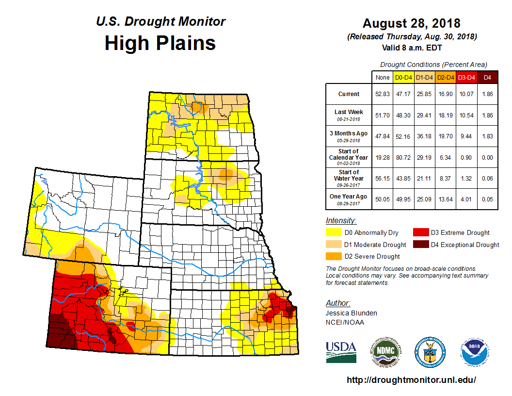
Frontal systems brought thunderstorms and some heavy rainfall to parts of the Plains, the Midwest, and the South, according to the Aug. 28 U.S. Drought Monitor released Aug. 30. While rainfall was enough to reduce or alleviate drought conditions in some places, such as Arkansas, northern Missouri, Kansas, Wisconsin, and Michigan, it wasn’t enough in other areas, such as southwestern Missouri and Idaho, as deficits and impacts remain. This past week saw temperatures slightly below average across much of the nation, with areas of eastern Montana and western North Dakota 4 to 8 degrees F cooler than normal, which helped to slow, but not halt, drought development. Conversely, parts of the Southwest, Texas, and areas along the eastern northern tier of the U.S. were well above their average temperatures. In Texas, notably, the widespread heat exacerbated evolving and ongoing drought.
In Kansas, conditions improved enough to contract D0 in the central and south central part of the state eastward. In east central Kansas, some areas of moderate (D1), severe (D2), and extreme (D3) drought also improved. However, there are still longer-term deficits and impacts remaining in the state. In eastern Colorado, D3 was improved to D2 in Crowley County and northern Otero County, where there were a few isolated thunderstorms in the area over the past week. D2 improved to D1 in southeast Las Animas County and western Baca County, where up to 2 inches of rain fell. Eastern Baca and Prowers Counties also received up to 2 inches of rain, allowing for improvement from D1 to D0. No changes were made this week to the depictions in South Dakota, Nebraska, and Wyoming.


