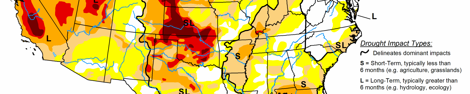
Moderate to severe drought expands in Kansas
A strong cold front progressed southeast across the Great Plains, Mississippi Valley, and Southeast on April 28 and 29. This cold front was a focus for a severe weather outbreak from Oklahoma and eastern Texas east to the middle and lower Mississippi Valley. As this front shifted south, heavy rain (more than 2 inches) fell from the western Gulf Coast east to the Florida Big Bend and Florida Gulf Coast.
A summer-like ridge of high pressure aloft led to an early and persistent heat wave across southern California and the Desert Southwest during late April into early May. Much above normal temperatures also affected the southern Rockies and southern Great Plains. To the north of this upper-level ridge, multiple low pressure systems along a nearly stationary front resulted in occasional thunderstorms with locally heavy rain (1 inch or more) to the central Great Plains, middle Mississippi Valley, and Ohio Valley.
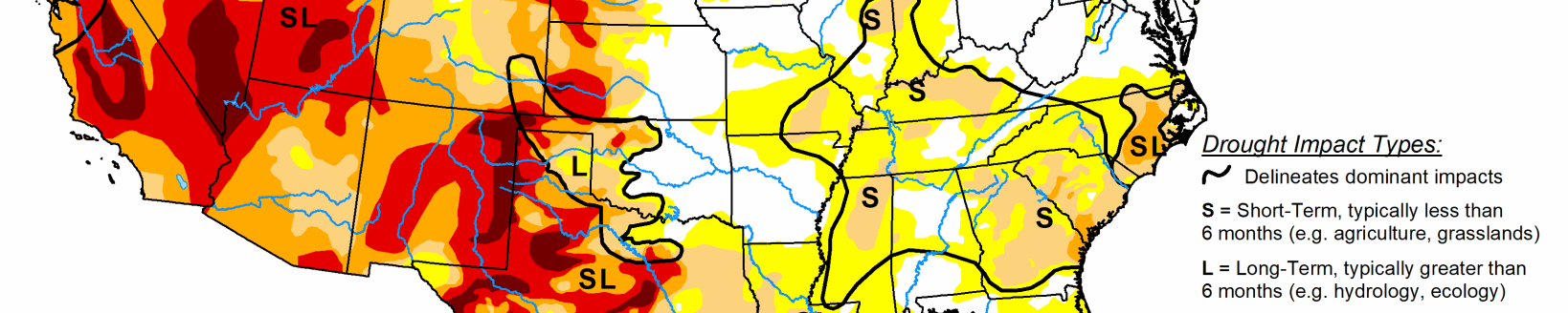
High Plains
Increasing short-term precipitation deficits, exacerbated by above-normal temperatures recently and high evapotranspiration rates, support an expansion of abnormal dryness (D0), moderate drought (D1), and severe drought (D2) across Kansas. 60-day precipitation deficits range from 2 to 4 inches extending from southwest Kansas northeast to north-central Kansas. Russell, Kansas, received only 0.40 inches of precipitation during April, which was the second driest on record (dating back to 1950) for the month. Russell’s normal April precipitation is 2.62 inches.
Abnormal dryness was reduced in coverage across parts of South Dakota that received more than 1 inch of rainfall at the beginning of May. Recent heavy rainfall (more than 1 inch) also brought a 1-category improvement to the high Plains of northeast Colorado. Conversely, a 1-category intensification of drought conditions were necessary across parts of western, southern, and southeast Colorado. Southern parts of the San Luis Valley and southeast Colorado have experienced abnormal heat and high evaporative demand. SPI values on multiple time scales support the introduction of extreme drought (D3) to parts of the San Luis Valley and southeast Colorado. Farther to the north, abnormal dryness (D0) was expanded northeast Wyoming that missed the recent rainfall and where 60-day SPI values support it.
South
Heavy rain (widespread amounts of more than 2 inches) at the end of April prompted a 1-category improvement to parts of the western and northern Gulf Coast, including southern Louisiana and southeast Texas. This recent heavy rain resulted in precipitation surpluses during the past 30 days and normal (25th to 75th percentile) 28-day streamflows. However, dating back 6-months, large precipitation deficits (more than 8 inches) remain across southeast Louisiana and the along the Mississippi Gulf Coast. In contrast to the improving conditions across southeast Texas, drought coverage/intensity remained nearly steady or worsened slightly across south Texas. Abnormal dryness (D0) was expanded across the Texas Panhandle and northwest Oklahoma due to increasing 30 to 60-day precipitation deficits, above normal temperatures (highs well into the 90s and low 100s), and periods of strong winds during late April into the beginning of May. These indicators along with impact reports (poor pastures, low ponds, and poor winter wheat quality) support the introduction of a small D1 area in northwest Oklahoma.
Midwest
The Corn Belt remains drought-free due to long-term precipitation surpluses, favorable soil moisture, and a cool start to spring (30-day temperatures averaging 2 to 4 degrees F below normal). A small area of abnormal dryness (D0) was decreased this week due to recent rainfall. The largest 30-day precipitation deficits (around 3 inches) exist across northern Iowa.