Collaboration brings new water management tool to Ogallala Aquifer irrigators
Now farmers can make irrigation decisions based on real-time well use data
Farmers have more data at their fingertips today than ever before in the history of agriculture.
From precision planting and application tools to in-cab displays of yields in real time during harvest, farmers of the 21st century can better manage their crop inputs from seed to the bin. That is, except for real-time measurements of irrigation.
Sure, moisture probes and sensors can give a farmer a better insight into his field conditions than the weather reports of 30 to 40 years ago. And metering can give an end-of-season report card when it comes to overall water usage. But when it comes down to knowing minute-by-minute how much water is being pumped out of their groundwater resource, farmers have been left with a best guess.
That is, until the Twin Platte Natural Resources District Water Data Program was formed in 2019. This collaboration brings public, private and government entities together in a common goal—provide real-time measurements of ground water use on the Ogallala Aquifer so that farmers can better manage this precious resource instead of relying on outdated models based on end-of-year data.
Manage what you can measure
Roric Paulman, Sutherland, Nebraska, farms about 10,000 acres in the TPNRD, the Middle Republican Natural Resources District, and the Upper Republican Natural Resources District. As a farmer and an innovator, he’s been using well meters and monitoring irrigation with soil moisture probes and using ET rates for crops for a long time.
“We use all the tools, but the component that was missing was the real time data,” Paulman said. Knowing at the end of the season that you pumped 12 inches of irrigation water on a well doesn’t really help you during the growing season. And knowing that you’re not only applying the right amount of water for the crop’s needs, but that you aren’t wasting any water that’s expensive to pump is critical to farmers who are tasked with preserving the precious resource.
Kent Miller, general manager of the TPNRD in North Platte, Nebraska, explained that in 2004 the Nebraska Legislature enacted integrated management legislation. The Upper Platte River Basin relies on ground water to flow into the river, and because of ground water use it was declared “over-appropriated.”
“For the TPNRD, that meant an immediate moratorium on new ground water development and no new acres could be irrigated,” Miller said. And the district had to develop an Integrated Management Plan that would find offset water to place in the river or regulate ground water users. The district’s board of directors did not want to impose regulations on ground water irrigators, and it did not want to require expensive water meters.
“The TPNRD estimated it would cost $5 million to install water meters on the 2,400 active irrigation wells in the TPNRD and $2 million per year to obtain the data and to maintain the meters in a reliable operating condition,” Miller explained.
But then in 2018, during the 10-year update of the district’s IMP, the state of Nebraska was still pushing for water meters for all ground water users in the district. What was the alternative?
The answer was an ingenious idea, Paulman said. Instead of measuring the water, you measure the electricity used to pump the water, in real time.
“Nebraska is a public power state, our rural electricity is provided through cooperatives and they have automated meter reading systems,” Paulman explained. “They can read your electric meter from their office 50 or 100 miles away.” So, why not attach Electric Smart Meters to irrigation wells in the farmer’s fields to measure the electricity used to pump water for irrigation?
It was a simple thought, but in reality there are a lot of moving parts and it took an epic collaboration to come up with the solution, and make it voluntary and free for growers in the district.
Collecting data from the field
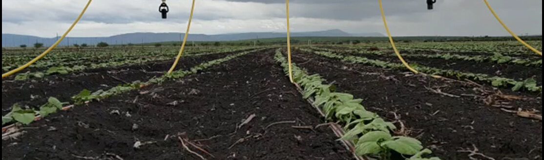
The first order of business was getting the data from the field to the cloud. But anyone who’s traveled through rural America knows not just the frustration of a dropped cell phone call, but also the frustration of trying to download or upload large packets of data in real time.
The district lacked adequate WiFi connectivity and running fiber cables to every irrigation pump or using cellular to upload the data from the well meters to the cloud was going to be cost prohibitive. Additionally, about 20% of the wells in the district are diesel-powered and needed a separate solution from electric wells. So the district reached out to Paige Wireless, a LoRaWAN network provider to connect the fields to the cloud.
According to Paige Wireless, it created an Internet of Things solution for the problem by deploying a statewide LoRaWAN network, a bi-directional, low-power wireless system for IoT communications. This network’s subscription costs just 10% of the standard annual cell subscription during the irrigation season, according to the company. Additionally, it created and installed low-cost, battery powered sensors, Electric Smart Meters, that can capture the irrigation usage, water applied and ground water recharge, according to the company. It even has LoRaWAN transmitters that can monitor the running time of diesel or natural gas powered wells and wirelessly transmit it to the cloud, too.
Next, in order for the data from the Electric Smart Meters to make sense, there needed to be accurate flow rates established for the irrigation wells on which they were installed. And because the TPNRD doesn’t have a water meter program it worked with the well drilling companies in the district to collect accurate well flow rates from growers who sign up in the program.
“For wells that have not had recent work with a well drilling company, the TPNRD assigns a company,” Miller explained. A side benefit to these new flow rate tests is the well drilling company representative onsite doing the test can recommend, if needed, an efficiency test of the well based on its age and condition. And the TPNRD will pay that additional cost.
“The efficiency test is not needed for the TPNRD, but the TPNRD is being a good neighbor in offering it for the benefit of the grower,” Miller said.
Now, with the known well flow rate, and the run time of the well based on the electric meters, combined with the acres of the field and the crop planted under the irrigation, the water use of the well can be determined. And this is where the Growers Information Services Cooperative and the engineering and design firm Olsson, come into the collaboration.
Crunching the numbers and making sense
To really meet everyone’s needs, the Water Data Program has to not only help farmers make their decisions in real time, but it also has to give the district a tool to create better water management models that it can use to back up its IMP to the state of Nebraska.
GiSC is a grower-owned and governed data cooperative based in Lubbock, Texas, that was founded to help farmers navigate the advancement of ag technology and their data storage needs. It has strategic partnerships with IBM and Main Street Data, and these allow member producers to have access to premier weather and data analytic platforms in the industry. It also aggregates and benchmarks operational data with other members so that farmers can better plan their farm decisions for the following year.
Paulman is on the board of directors of GiSC, and he brought the cooperative to the attention of Miller as a collaborative partner in the Water Data Program. The district and GiSC now have an agreement that the data cooperative will securely collect and store the data from the wells and provide it to producers via its AgHub digital app. Farmers can access their well flows, hours of pumping, acreage and crop types on the app. This dashboard puts the power in the producer’s pocket.
Additionally, GiSC will also aggregate the data collected from all the farmers enrolled in the program. This aggregated data is the only data that TPNRD has access to and it will be used to help the district create better ground water models that are used for its Integrated Management Plan.
Helping the district work to build a better model is Jim Schneider, a senior scientist for Olsson’s water team. Schneider was once the acting director of the Nebraska Department of Natural Resources and was an expert witness for the State of Nebraska in litigation regarding the Republican River water usage compact in 2012. He’s all too familiar with the vital role irrigation plays in the state’s agricultural future and the complications in traditional water modeling.
So, when the TPNRD posed the challenge, Schneider and his team jumped on the chance to shift how ground water models are created.
They came up with the Groundwater Evaluation Toolbox, which is a cloud-based platform that “evaluates the future impact on ground water supplies before management scenarios are employed, creating the ability to save time, expense and water,” according to the company literature. Schneider also led a team of computer programming and engineering students from the University of Nebraska-Lincoln to create a sensor that would track groundwater levels and a computer dashboard that would monitor water fluctuations from a laptop.
GET collects the data from the power meters on the irrigation wells, factors in precipitation and evapotranspiration data, and then creates models that will show real time irrigation usage, stream flow impacts, and weather data that the TPNRD can use.
Many hands, one mission
All of these components and collaborators were brought together by rural ingenuity. This is the brainchild of many, Paulman said, but the opportunities that exist for the farmer to better use his data and the district to help its irrigators is just phenomenal.
“This is the kind of thing that you get when you work with rural people in agriculture,” he added.
And farmers in the TPNRD are signing on. As of Oct. 1, there have been 621 total irrigation wells connected, covering 47% of the 313,630 active irrigated acres in the TPNRD. Growers started getting data in July. Miller said they hope to have 100% of irrigators in the district signed up by the end of the year, but COVID-19 restrictions canceled many of their in-person education sessions they’d planned this spring and summer.
Miller said that the cost for the TPNRD to set up the Water Data Program for its initial four years runs about $3.592 million, and it has received a Nebraska Water Sustainability Fund grant to cover about $1.65 million. And after the initial four years, the ongoing annual cost is only estimated to be about $685,000. That’s a significant cost savings to just putting on water meters, he said. But it also will produce much more accurate data for groundwater modeling and any future challenges to irrigation use of the Ogallala Aquifer.
Environmentalists have put farmers in the hot seat when it comes to water usage out of the Ogallala Aquifer, and projects like this are how farmers can show that they are being responsible stewards of the resource, Paulman said.
“What Twin Platte has done, that changes your behavior as an irrigator,” he said. By knowing how much you’re physically drawing down, and putting that in the palm of the producer, that can help a farmer save $6 to $8 per acre foot of pumped water costs.
“If you’re under allocation like we are on the Republican Basin, you have to be precise and understand that you have an impact on the natural resource,” Paulman added. “You’re irrigating a crop that is your lifeblood, but you’re also responsible for the natural resource, and that’s the ‘aha’ moment. But it’s also the partnership with the district, because we know we have to provide better data. If we don’t provide better data then we’ll be on our heels and on the run. It’s better to be proactive and responsible and transparent.”
To learn more about the TPNRD Water Data Program, or to sign up if you’re an irrigator in the TPNRD, visit https://tpnrd.org/Programs/Ground-Water/TPNRD-Water-Data-Program.
Jennifer M. Latzke can be reached at 620-227-1807 or [email protected].
Related Articles