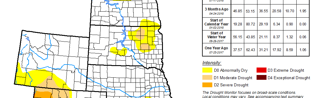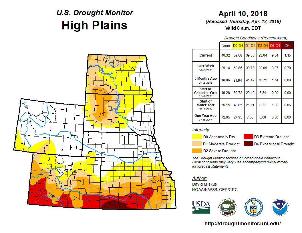
According to the U.S. Drought Monitor released April 12, another week of light precipitation (snow) and subnormal temperatures enveloped the northern Plains, with some heavier amounts (0.5 to 1 inch) falling on northern and eastern South Dakota and the Black Hills. In east-central South Dakota, 4 to 8 inches of snow fell from Aberdeen southeastward past Watertown, and with this moisture, a slight D0 removal was made where indices out to 6 months were wet, and since this D0 was short term, it was easier to justify its removal; however, the D0 was kept where frost depths were deeper (down to 2 to 4 feet) in the northeast.
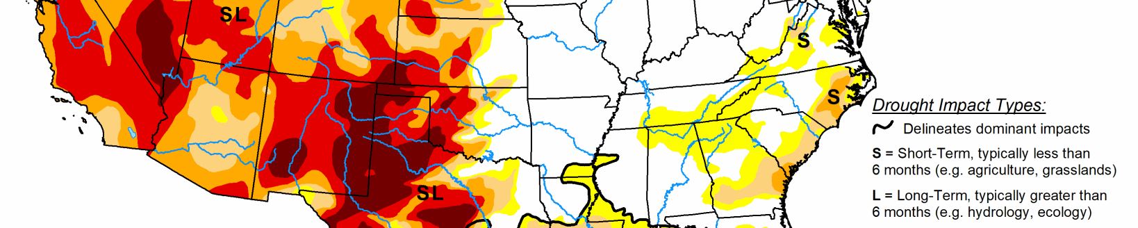
After several weeks of gradual improvements in eastern Montana and the western Dakotas, no changes were made this week as precipitation was lighter. In northern Colorado, some decent precipitation fell on the central Rockies, finally allowing for some small 1-category improvements in northwestern and north-central sections of the state as WYTD indicators climbed above various D0-D2 percentile thresholds. Farther south, similar to other south-central Plains states, Kansas saw little or no precipitation (less than 0.25 inches) as not only short-term indices (6 months or less) but also longer-term tools (9 and 12 months) indicated drier conditions than depicted. Accordingly, the D4, D3, D2, and D1 borders were slightly extended northward to reflect the severe conditions and growing deficits (8 to 14 inches at 12 months in central Kansas). The April 8 USDA National Agricultural Statistics Service winter wheat rating for Kansas stood at 44 percent in poor or very poor condition, with Kansas the top state for winter wheat production. No changes were made between the border of Nebraska and Kansas as a few extra snow events this year across this area have contributed enough moisture to prevent deterioration, at least for now.