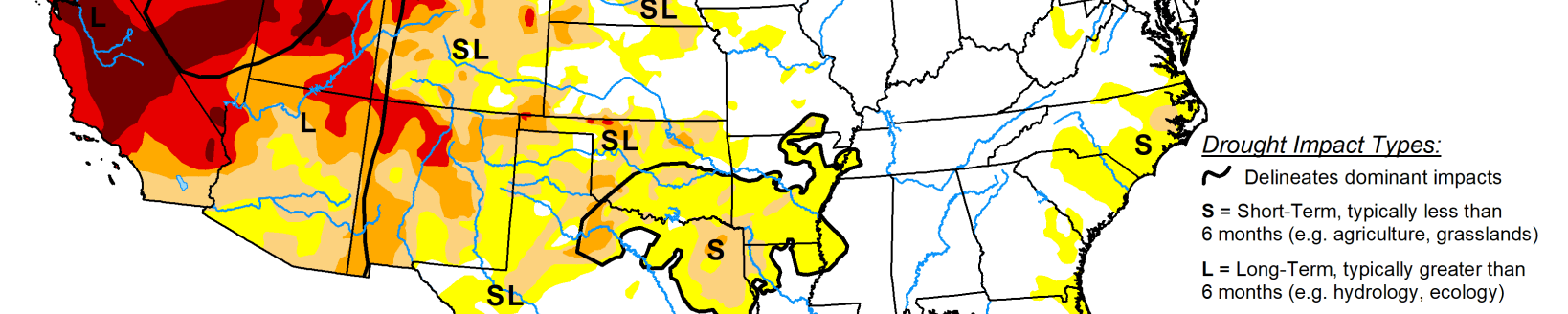
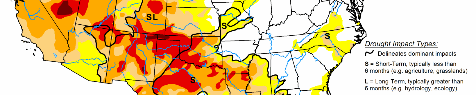
Weather systems bring beneficial precipitation to areas of Rockies, Plains and Midwest
According to the U.S. Drought Monitor for Nov. 27 released Nov. 29, a series of upper-level weather systems and their associated surface lows and fronts moved across the contiguous U.S. during this U.S. Drought Monitor week. They brought beneficial precipitation to much of the Pacific coast; parts of the northern and central Rockies, central Plains, Midwest, and Gulf of Mexico coast; and much of the Mid-Atlantic to Northeast. But they missed much of the Southwest, northern Plains, and southern Plains, where no precipitation, or less than a tenth of an inch, fell. Based on precipitation recorded through the 12z (7 a.m. EST) cutoff on Tuesday morning, the precipitation was less than the weekly normal across parts of the interior Pacific Northwest and northern New England, and much of the Midwest and Southeast. While beneficial, the precipitation in the West was mostly not enough to overcome months of precipitation deficits. Slight contraction of drought or abnormal dryness occurred in parts of Arizona (a reassessment), Colorado, and Montana, while expansion occurred in southern California and Nevada. Building precipitation deficits prompted expansion in the southern Plains. Rain and snow from the weather systems this week—and previous weeks to the last 6 months—have built up precipitation surpluses across much of the country east of the Mississippi River, with streamflow mostly above normal and Nov. 25 reports from the U.S. Department of Agriculture showing soil moisture surpluses in most states here, Florida and coastal Georgia and South Carolina being the exceptions. Contraction and expansion of abnormal dryness occurred in coastal Georgia and South Carolina to accommodate a variable precipitation pattern.
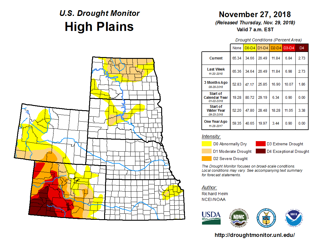
In the High Plains, half an inch to an inch of precipitation fell in areas across Wyoming, Nebraska, and northern Kansas, with little to no precipitation occurring in the Dakotas and the High Plains of Montana. The precipitation was not enough to affect the D0-D1 lingering in northeast Kansas. Even though the week was drier than normal in north central Montana, the D0 there was trimmed to reflect a reassessment of the impact of precipitation in recent weeks. The D0-D1 in the Dakotas reflected lingering long-term dryness.
In Midwest a band of 0.5 to 2.0 inches of precipitation stretched from northern Missouri and southern Iowa to Lakes Erie and Huron; 0.5 to 1.0 inch was spread across the Lake Superior area; and 0.5 to 1.5 inches occurred across Indiana and Ohio. Outside of these areas, less than half an inch of precipitation fell. Most of the Midwest was free of drought or abnormal dryness. The precipitation that fell across Missouri was not enough to affect the existing D0 in western and northern Missouri. With continued dryness across southern Missouri, D0 spread into the southwestern portion of the state to reflect mounting deficits over the last 3 to 6 months, as well as lingering dryness at the 6 to 12 month time scales. The short-term dryness was evident in such drought indicators as the SPI, soil moisture models, and Vegetation Health Index.