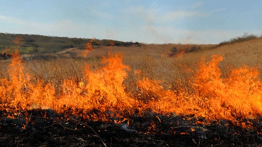
Lightning strikes cause wildfires in New Mexico, Panhandles and southwest Kansas
Numerous lightning strikes caused wildfires in the Southwest and High Plains May 14 and 15.
Here is a glance at the fires.
New Mexico
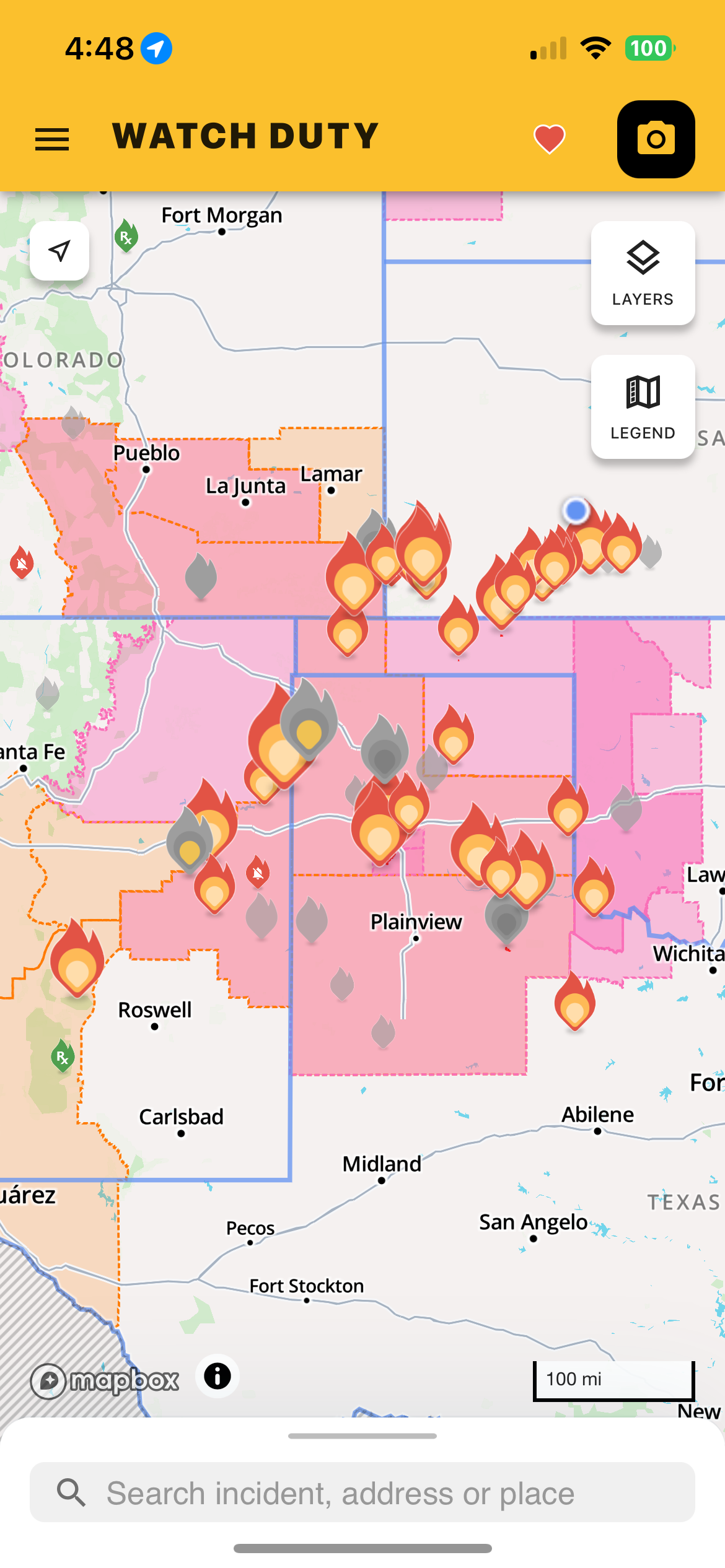
The Line Fire started May 14 at approximately 10 a.m., near the New Mexico/Texas state lines, and has burned 23,000 acres. Cause is undetermined, and as of early May 15, the fire is 25% contained. Texas A&M Forest Service crews are working in unified command with New Mexico and local resources. At one time fires forced the closure of U.S. Highway 54.
Forward progression of the fire was reported early in the morning hours of May 15, as crews worked through the night to construct containment lines. Suppression efforts were ongoing.
Weather conditions are concerning as winds are expected to blow out of the southwest at 10 mph or more. Relative humidity levels are expected to drop into the single digits as temps reach the mid-90s on May 15.
Texas
The Hunggate Fire started at approximately 4:30 p.m. May 14, when dry lightning started a series of wildfires in Randall County. According to reports, Texas A&M Forest Service was requested by Randall County Fire Department for a fire off FM 1705 and Buffalo Lake Rd. The fire jumped FM 1714 and moved north with multiple structures being threatened.
Texas A&M Forest Service is working in unified command with Canyon Fire Department. Fire engines are currently doing structure protection, and heavy equipment is engaging on both flanks. Aviation resources are also being utilized. The forward progression has stopped.
Other fires started on May 14 and 15.
For information on assistance to those affected by the wildfires in Texas visit texasagriculture.gov/Home/Production-Agriculture/Disaster-Assistance/STAR-Fund/Wildfire.
Kansas
Five counties in southwest Kansas—Clark, Ford, Harper, Meade, and Morton—were all verbally declared a state of disaster due to wildland fires, according to KAKE News reports. The verbal declaration came from Kansas Gov. Laura Kelly on May 15, to allow resources to be used for state assistance.
“Weather conditions are such that a high risk exists for wildland fires,” Gov. Kelly said in a statement. “I urge everyone across the state to use extreme caution and avoid burning and any activity that may spark a fire. We encourage residents to remain vigilant, follow local emergency guidance, and continue supporting one another as response efforts continue.”
Southwest Kansas will continue to experience hot, dry weather throughout the weekend May 16 and 17 with above seasonal averages. Weather experts say the relative humidity values are expected to fall into the 15 to 25% range during peak heating hours, creating elevated to critical fire weather conditions across portions of the region where fuels remain receptive.
Thunderstorm chances will increase during the late afternoon and evening hours through the weekend. While rainfall coverage may remain scattered, any storms that develop could produce lightning, strong outflow winds, and localized heavy rain. A stronger frontal passage is expected early next week, bringing cooler temperatures and improved humidity conditions by May 19.
In a video posted on Facebook, Kansas Forest Service’s Chip Redmond explained the wildland fire situation May 14 and 15.
“It might seem like fire season is done for a lot of folks,” he said.
Green up has started for many areas where precipitation has been received, but many areas haven’t been as fortunate.
“However, most of the western two-thirds of the state is in at least moderate to extreme drought, and we see continued fire concerns, and that was realized yesterday, where we saw extreme fire behavior with a significant lightning event in southwest and south central Kansas,” he said. “Unfortunately, the vegetation that area is still very cured out.”
Energy Release Components, or ERCs, are much above normal rates, reaching the 80th percentile, Redmond said.
“And so, we’re seeing very aggressive fire behavior,” he said. “Additionally, unfortunately, the wheat is already turning. In a lot of places where it hasn’t failed, it’s starting to cure out, and it’s able to carry fire, so we have less barriers and resistance to spread on the landscape. That’s resulted in a continuous landscape that’s able to carry fire very effectively.”
Even with the lightning event in the past, there’s still a lot of fire that remains. Redmond expects hot, dry conditions through at least May 18 in southwest and south-central Kansas. Winds are expected to increase up to 50 mph May 17 and 18, creating even a more dangerous situation.
“Let’s be really smart. We’re not done with fire season yet,” Redmond said. “Unfortunately, precipitation is going to be hard to come by for a while, especially for that neck of the woods, so let’s do everything we can to prevent fires.”
Resources for Kansas farmers and ranchers can be found on the Kansas Department of Agriculture website, in the Kansas Wildfire Recovery Resources tab at www.agriculture.ks.gov/.
Kylene Scott can be reached at 620-227-1804 or [email protected].