
Free satellite imagery, spray drones highlight precision agriculture opportunities
One of the biggest opportunities in precision agriculture may already be available at no cost.
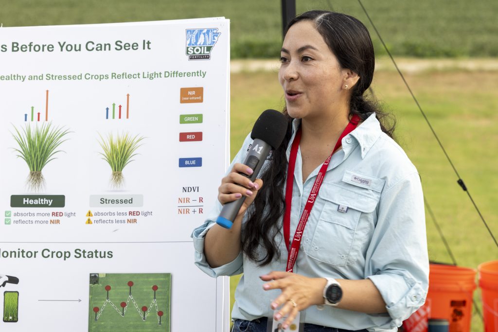
For Ana Morales-Ona Smith, that opportunity became part of her initial research as a new extension soil fertility specialist and assistant professor in the department of crop, soil and environmental sciences for the University of Arkansas Division of Agriculture.
“The U.S. has so much freely available spatial data that is ready to use, and very little is used for agriculture,” Smith said during the 2026 Rice and Soybean Field Day at the Northeast Rice Research and Extension Center in Harrisburg.
To help growers identify crop stress and guide fertilizer decisions, Smith compared freely available satellite imagery, commercial satellite data, drone imagery and handheld sensor readings to evaluate how existing data can be used before investing in additional technologies.
Many crop sensing tools used in precision agriculture measure light reflected by plants. Healthy and stressed plants reflect light differently, allowing sensors to detect potential problems before visible symptoms appear.
“When we see areas that are not looking great in a field, it may already be too late,” Smith said. “Sensors can help us detect stress earlier so we can take timely actions before yield is affected.”
Early results from her research comparing the data sources show that different systems often capture similar trends in crop response despite large differences in image resolution. The findings raise an important question: how much value does increasingly detailed imagery provide?
She believes combining imagery with tissue sampling and other agronomic measurements could help support site-specific nutrient management, allowing fertilizer applications to be targeted where they are needed most.
“You don’t need a drone to begin using aerial imagery,” Smith said. “Free historical satellite imagery can help you identify consistent patterns of crop variability across your fields. Combined with soil and tissue sampling, satellite imagery can help target nutrient applications where they are needed most.”
The free Sentinel-2 satellite imagery is available at a 10-meter resolution — meaning each pixel represents an area of about 33-by-33 feet on the ground — and imagery is acquired every few days, with data going back to 2015.
Making better nutrient decisions
One practical application of the imaging technologies is determining whether rice needs additional nitrogen during the growing season.
Smith highlighted existing work in Arkansas that uses GreenSeeker, a handheld sensor that collects readings from reference plots receiving ample nitrogen. By comparing sensor readings from those well-fertilized areas with readings collected throughout a field, growers can determine whether additional nitrogen applications are warranted.
While effective, collecting data across numerous fields with a handheld device can present logistical challenges during narrow fertilizer application windows, she said. That challenge led her to investigate the potential of aerial imagery as an alternative.
Evaluating spray drone performance
Interest in agricultural drones has expanded rapidly across Arkansas and the nation, but researchers are still working to define the operational factors that maximize performance.
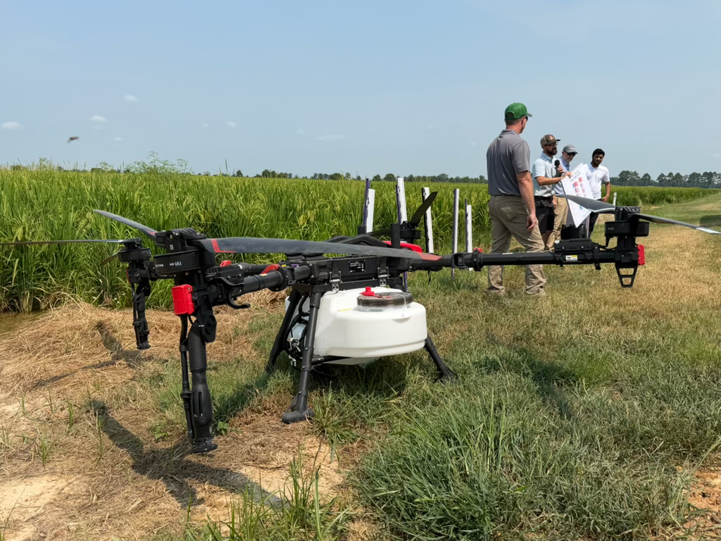
While Smith’s work focuses on collecting information about crop conditions, research led by Jason Davis, assistant professor and remote sensing and pesticide application extension specialist, and Terry Spurlock, professor and extension plant pathologist, is examining how drones can act on that information.
Davis and Spurlock have been studying fungicide applications made by spray drones and comparing them with conventional ground-based applications.
In one study, they compared fungicide applications on rice made using a traditional MudMaster ground sprayer to those made by drones flown at two speeds, 30 and 40 miles per hour. The goal was to evaluate not only disease control but also spray coverage throughout the crop canopy.
Water-sensitive paper was placed throughout the plots to visualize how spray droplets were distributed. The work showed that increasing drone speed from 30 to 40 mph reduced spray coverage by about 20 percent.
However, Davis emphasized that reduced coverage does not automatically translate to reduced disease control.
“This is not efficacy,” Davis said. “Coverage tells us where the spray droplets are deposited, but it doesn’t necessarily predict how well the product will control disease.”
Previous trials have shown that spray drones can provide effective disease management when properly configured, he noted.
Finding the sweet spot
Davis and Spurlock say the challenge is identifying operational settings that provide sufficient coverage while maintaining the efficiency that makes drones attractive to growers.
The results also highlight important distinctions between different crop protection products.
For fungicides and other systemic products that move within plant tissues, the observed coverage patterns may be adequate. More uniform coverage may be required for products that rely on direct contact with pests or plant surfaces.
Spurlock said fungicide applications are often targeting the upper portion of a crop canopy during critical reproductive growth stages.
Because the most important leaves for photosynthesis are often located near the top of the plant, limited penetration into lower canopy layers may not necessarily be a disadvantage, he explained.
Future work will focus on connecting the dots between spray coverage and disease control, with the goal of identifying the flight speeds, application heights and spray setups that perform best.
Mention of product names does not imply endorsement by the University of Arkansas Division of Agriculture.
To learn more about ag and food research in Arkansas, visit aaes.uada.edu. Follow the Arkansas Agricultural Experiment Station on LinkedIn and sign up for our monthly newsletter, the Arkansas Agricultural Research Report. To learn more about the Division of Agriculture, visit uada.edu. To learn about extension programs in Arkansas, contact your local Cooperative Extension Service agent or visit uaex.uada.edu.
PHOTO: SPRAY DRONE — Research by Jason Davis and Terry Spurlock with the University of Arkansas Division of Agriculture seeks to identify optimum flight speeds, application heights and setups for agricultural spray drones. (UADA photo)