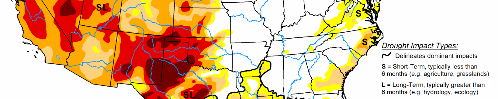
This U.S. Drought Monitor for Nov. 13 saw improvements on the map across parts of the Southeast, Northeast, Northern Plains, the Rockies, and Desert Southwest. In the mountains of drought-stricken areas of Colorado and New Mexico, the cool season is off to a positive start in portions of the central and southern Rockies where snow shower activity continued this week. In California, persistent dry conditions led to expansion of areas of drought in northern parts of the state where a dangerous and fast-moving wildfire broke out late last week in the Sierra Nevada foothills leading to destruction of the community of Paradise. The Camp Fire is now the most deadly and destructive fire in the state’s history and so far has resulted in the loss of 48 lives and destroyed 7,600 homes. In southern California, the Woolsey Fire broke out late last week and spread quickly across the Santa Monica Mountains because of dry vegetation and strong Santa Ana winds. The fire led to the evacuation of more than 100,000 residents in Los Angeles and Ventura counties and has been responsible for the destruction of >400 homes. In the Southeast, widespread rain shower activity helped alleviate areas of dryness in Alabama and Georgia while short-term precipitation deficits led to expansion of drought in portions of Florida.
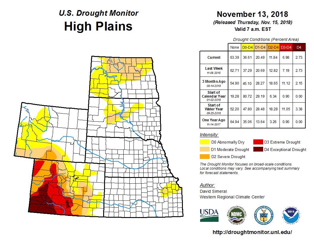
On this week’s High Plains map, improvements were made in North Dakota with the removal of two areas of Severe Drought (D2) in response to normal to above-normal precipitation during the past 30-to-60 days. In northeastern Kansas, areas of Abnormally Dry (D0) and Moderate Drought (D1) were reduced in response to improving soil moisture conditions and above-normal precipitation during the past 60-to-90 days. For the week, the region experienced below-normal temperatures with the largest negative anomalies (12-to-24 degrees below normal) observed in North Dakota, northeastern Nebraska, and northeastern Wyoming.
During the past week in the Midwest, scattered snow shower activity continued across the Upper Peninsula and northern Michigan with the heaviest accumulations (4 to 12 inches) observed in areas adjacent to Lake Superior. According to NWS NORHSC, the Northern Great Lakes region is currently 78 percent covered by snow. In terms of drought, this week’s removal of a small area of Moderate Drought (D1) in western Missouri resulted in the region currently being drought-free on the map. For the week, average temperatures were well below normal across the region with the greatest negative anomalies (12 to 20 degrees below normal) observed in Iowa and Minnesota.