Little precipitation received in High Plains
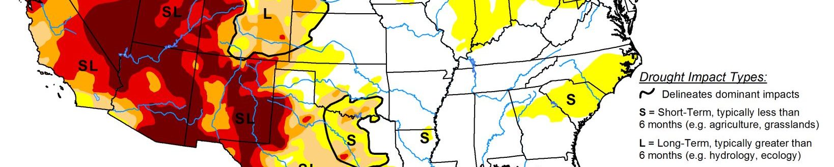
A series of Pacific weather systems continued to move across the contiguous U.S. in a fairly westerly jet stream flow during this U.S. Drought Monitor week. The systems dropped copious amounts of precipitation along the Coastal and Cascade mountain ranges of Northern California and the Pacific Northwest, with above-normal precipitation continuing across most of the Pacific Northwest to the Rockies.
The Pacific systems were dried out once they crossed the Rockies, but some picked up Gulf of Mexico moisture to provide above-normal precipitation from parts of New Mexico northeastward to the Great Lakes. Surface lows were generated by the upper-level Pacific systems, with some tracking to the Northeast and others moving along the Gulf Coast. The Gulf lows gave Texas to the Lower Mississippi Valley above-normal precipitation, while the others generated above-normal precipitation in the Middle Appalachian to Mid-Atlantic states. It was drier than normal from California to the Rio Grande Valley, across most of the northern Plains and Southeast, and parts of the central High Plains and Ohio Valley. With a westerly flow, most of the CONUS was warmer than normal, with only the Southeast having near to cooler-than-normal temperatures.
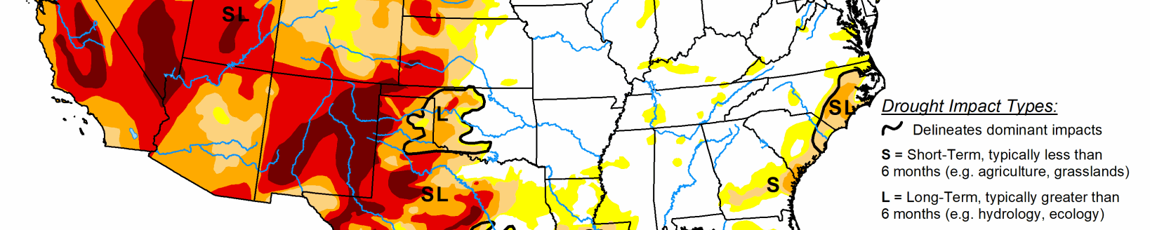
High Plains
Much of the High Plains region had less than a tenth of an inch of precipitation this week. Half an inch or more fell across southeastern Nebraska to southern Kansas and in the mountains of Colorado and western Wyoming, with pockets of 0.25-0.50 inch elsewhere. Although 6-month precipitation deficits are still significant, D2 was deleted in western and southern Colorado where recent precipitation made 1 to 3-month precipitation deficits and drought indicators less severe and where mountain snowpack was near normal. D0-D2 were trimmed slightly in southwest Kansas where precipitation was above normal this week. Reports from eastern Colorado indicate that the recent lack of precipitation is deteriorating conditions. Topsoil is blowing about in the wind, and winter wheat needs more moisture before green-up, so this area will be watched for deterioration in the coming weeks. Based on USDA reports, topsoil moisture was short to very short (dry to very dry) across 61% of Colorado, 32% of Kansas, and 24% of Wyoming; 23% of the pasture and rangeland was in poor to very poor condition in Colorado; and 24% of Colorado’s winter wheat and 23% of winter wheat in Kansas was in poor to very poor condition. USDA reports from Colorado’s southeastern counties included: “conditions were noted as extremely dry and moisture was needed. A reporter noted high winds severely damaged or blew out winter wheat stands in [some] areas. Livestock were being heavily supplemented.”
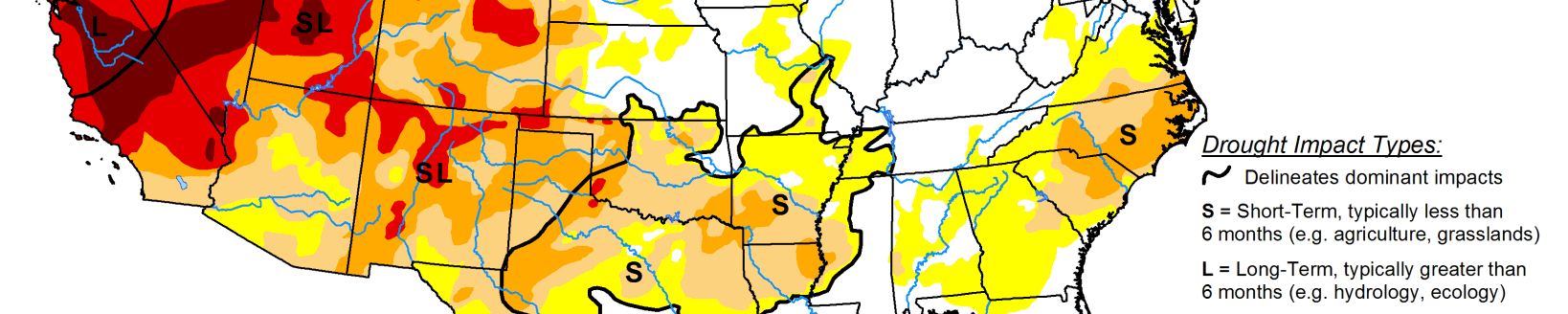
Midwest
Less than 0.25 inch of precipitation fell across most of Minnesota and parts of southeast Illinois to southwestern Indiana, while most of the Midwest received half an inch or more, and locally more than an inch. With most of the region experiencing wet conditions for the last 1 to 12 months, there was no drought or abnormal dryness in the Midwest this week.
South
Eastern portions of the South region received widespread half inch or more of precipitation, while western Texas was dry, especially along the Rio Grande Valley. An inch or more of precipitation fell from eastern Texas and southeast Oklahoma to the Mississippi River, with embedded areas of 2+ inches along the Gulf Coast and from northern Louisiana to southern Arkansas. Half an inch or more also fell in the Oklahoma panhandle and northern portions of the Texas panhandle. Consequently, drought and abnormal dryness contracted in parts of Texas, Oklahoma, Louisiana, and Arkansas. But drought or abnormal dryness expanded or intensified in parts of western Texas, southern Louisiana, and southeast Mississippi. The USDA reported that 28% of Tennessee’s pasture and rangeland was in poor to very poor condition, but, as for the Southeast, this was due to autumn drought, followed by insufficient time for re-growth before winter.