Mixed bag of precipitation and heat dot the Plains
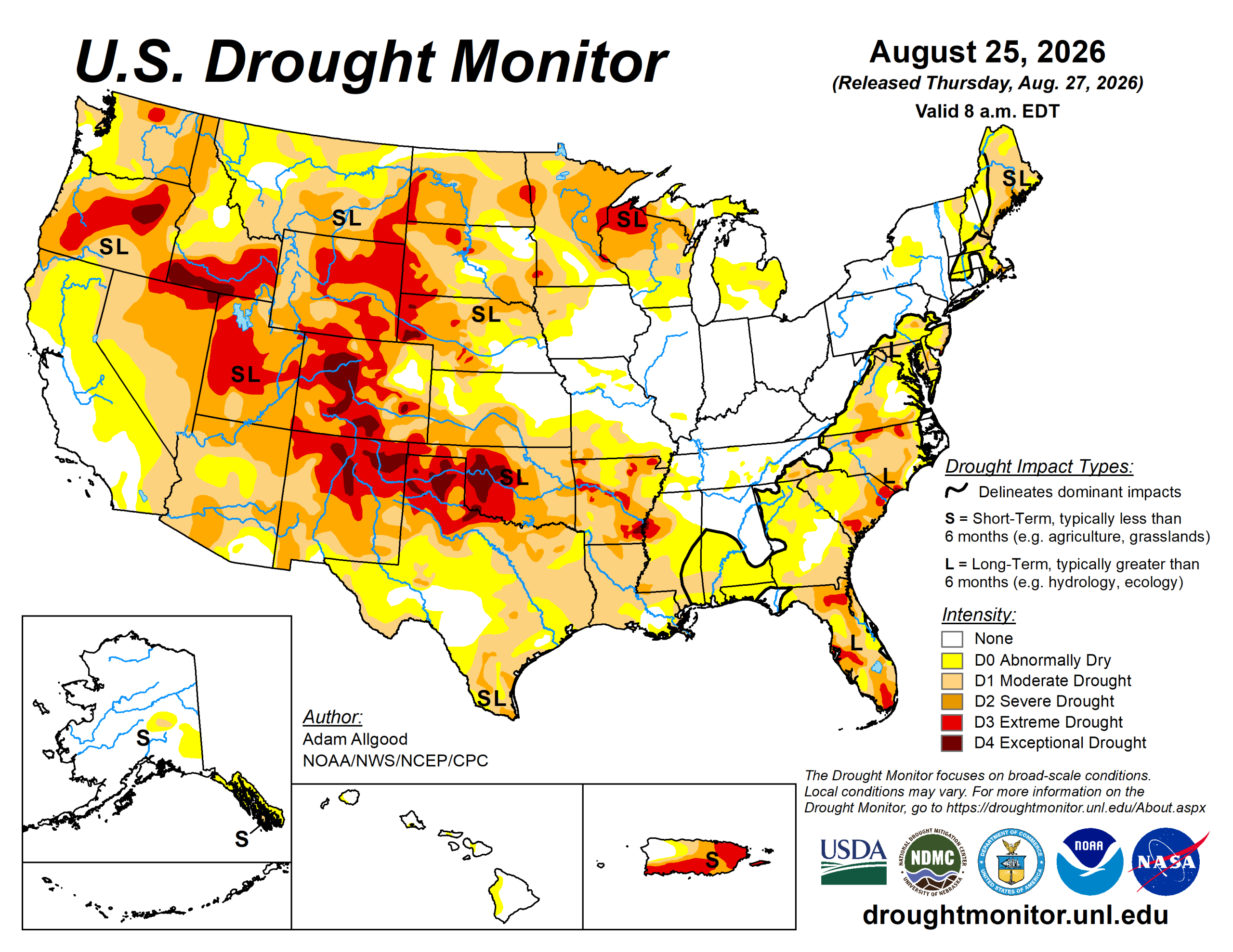
During the early part of last week, an amplified ridge-trough pattern over North America brought widespread late summer heat to the West and south-central United States.
Milder temperatures overspread the Corn Belt. The north side of the mean ridge provided a focus for convective activity, with narrow swaths of locally heavy rainfall extending across Nebraska and Missouri, while shortwave troughs brought several rounds of storms to the eastern Corn Belt. Underneath the ridge, dry weather combined with excessive heat continued to promote rapid onset drought across much of the South region.
Across the West, an active monsoon pattern continued to bring localized relief to parts of Arizona and New Mexico, while excessive heat and drier conditions promoted drought expansion across eastern New Mexico and portions of the Intermountain West, Great Basin, and the Northwest.
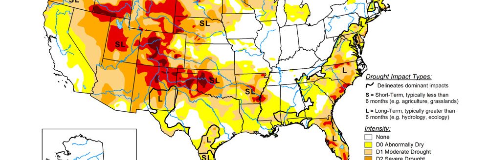
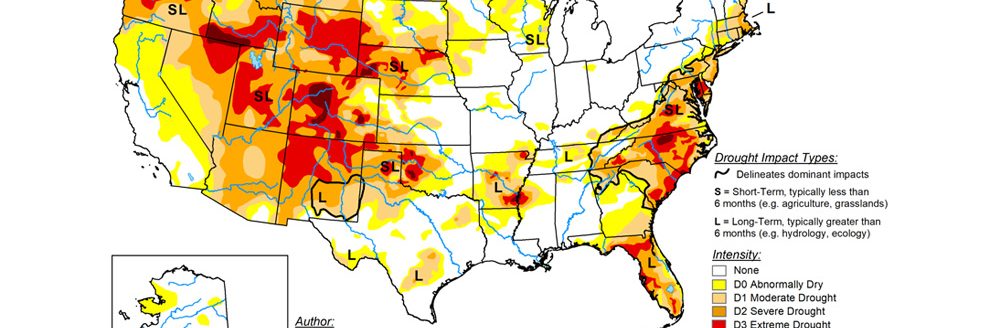
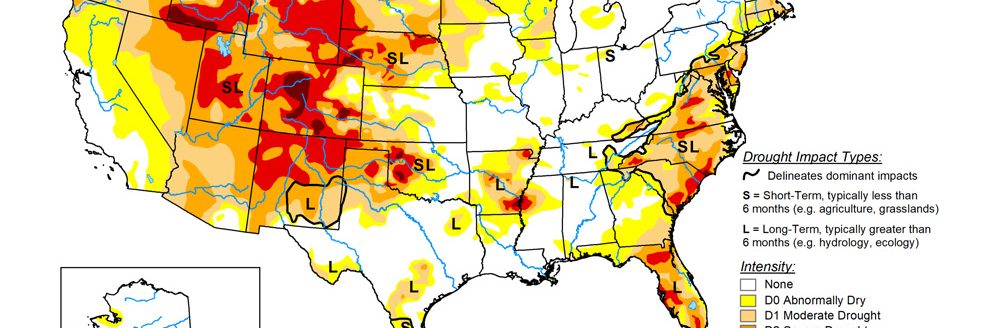
The U.S. Drought Monitor is jointly produced by the National Drought Mitigation Center at the University of Nebraska-Lincoln, the U.S. Department of Agriculture and the National Oceanic Atmospheric Administration. (Map courtesy of NDMC.)
South
Under a persistent heat dome ridge maintaining mostly dry conditions and unrelenting heat, widespread rapid drought expansion continued for another week across the South region.
Weekly maximum temperatures exceeded 100 degrees Fahrenheit across nearly the entire region and peaked above 110 degrees along the Texas-Oklahoma border.
Condition Monitoring Observer Reports submitted to the National Drought Mitigation Center highlighted rapidly worsening impacts, including dry stock ponds, wilting trees, dust storms, and elevated wildfire activity. Drought expansion and intensification were most pronounced across Texas, Oklahoma and Arkansas, while conditions also began to noticeably deteriorate across Mississippi. Small-scale convection provided only highly localized, brief relief to isolated portions of central Oklahoma and Arkansas.
Midwest
Following the widespread heavy rainfall that fell across the Corn Belt in the previous week, lighter precipitation and milder temperatures overspread the region.
In contrast, another dry week across portions of Minnesota aggravated ongoing drought impacts, leading to localized degradation. Severe drought expanded across eastern Minnesota.
High Plains
The High Plains saw a mixture of drought degradation and localized improvement.
Rapid drought deterioration continued across southern Kansas and southeastern Colorado, where dry conditions and excessive heat aggravated agricultural impacts. Farther north, widespread convection brought drought relief east of the Front Range across eastern Colorado, though some deterioration occurred in the Rockies of Colorado and Wyoming where water storage impacts from last spring’s limited snow cover are beginning to mount.
Organized convection along the northern periphery of the ridge promoted drought reduction in central Nebraska. Showers mostly maintained a status-quo depiction across South Dakota, save for small areas of degradation along its respective borders with North Dakota and Minnesota.
More widespread drought degradation was noted across North Dakota, where precipitation was sparser outside of a single, narrow convective event that tracked across the northeastern corner of the state.
West
Seasonal dryness continued across much of the Great Basin, where persistent above-normal temperatures drove high demand on water resources and led to localized degradation. Ongoing monsoonal convection promoted drought relief across much of Arizona and western New Mexico, though persistent heat and dry conditions drove drought expansion across eastern New Mexico.
Looking ahead
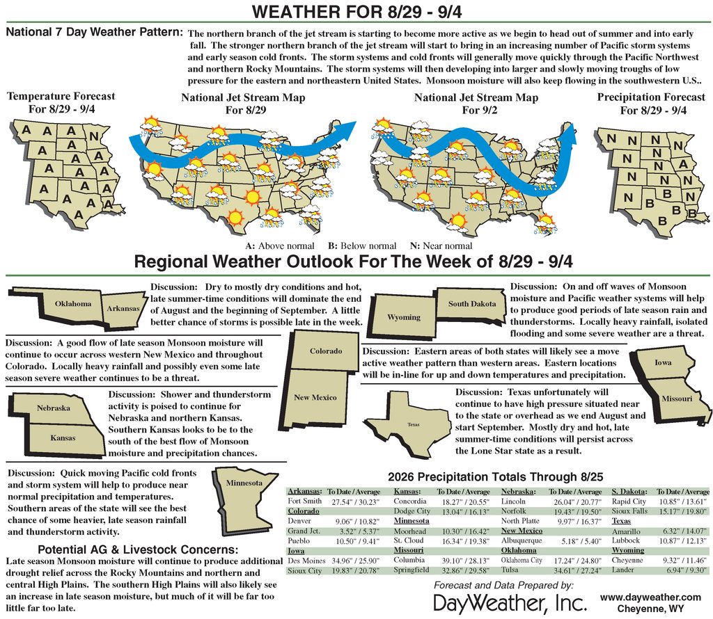
Over the next seven days, upper-level ridging centered over the western U.S. is forecast to progress eastward, shifting hotter conditions to the East while bringing a potential reprieve from extreme temperatures to the West.
Excessive heat will persist across the south-central U.S., which may continue to fuel rapid drought expansion and intensification. Enhanced monsoonal convection is favored across Arizona, with moisture extending northward into Utah and parts of the northern Rockies, while light, early-season precipitation may overspread southern California. Forecast precipitation amounts across the South region would be insufficient to offset ongoing moisture deficits.
Across the Midwest, light to locally moderate precipitation is expected. Seasonal convection will linger across the Southeast early in the period before drier conditions move in by the end of the period.
For the 8-to-14-day period, below-normal temperatures are favored across the Northwest, while elevated odds for above-normal temperatures extend across much of the remainder of the CONUS. The highest probabilities for excessive heat remain anchored over the south-central and southeastern U.S., maintaining heavy evapotranspirative demand in regions experiencing rapid drought degradation.
The precipitation outlook exhibits a weaker signal for the CONUS, with slightly enhanced chances for above-normal precipitation across the western U.S., while near-normal precipitation is favored elsewhere..
Adam Allgood is with NOAA/NWS/NCEP/CPC.