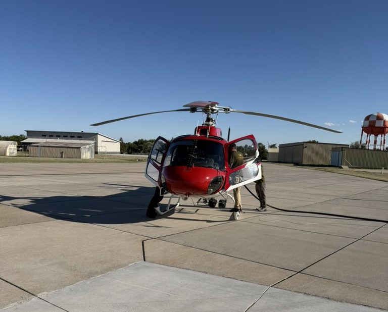
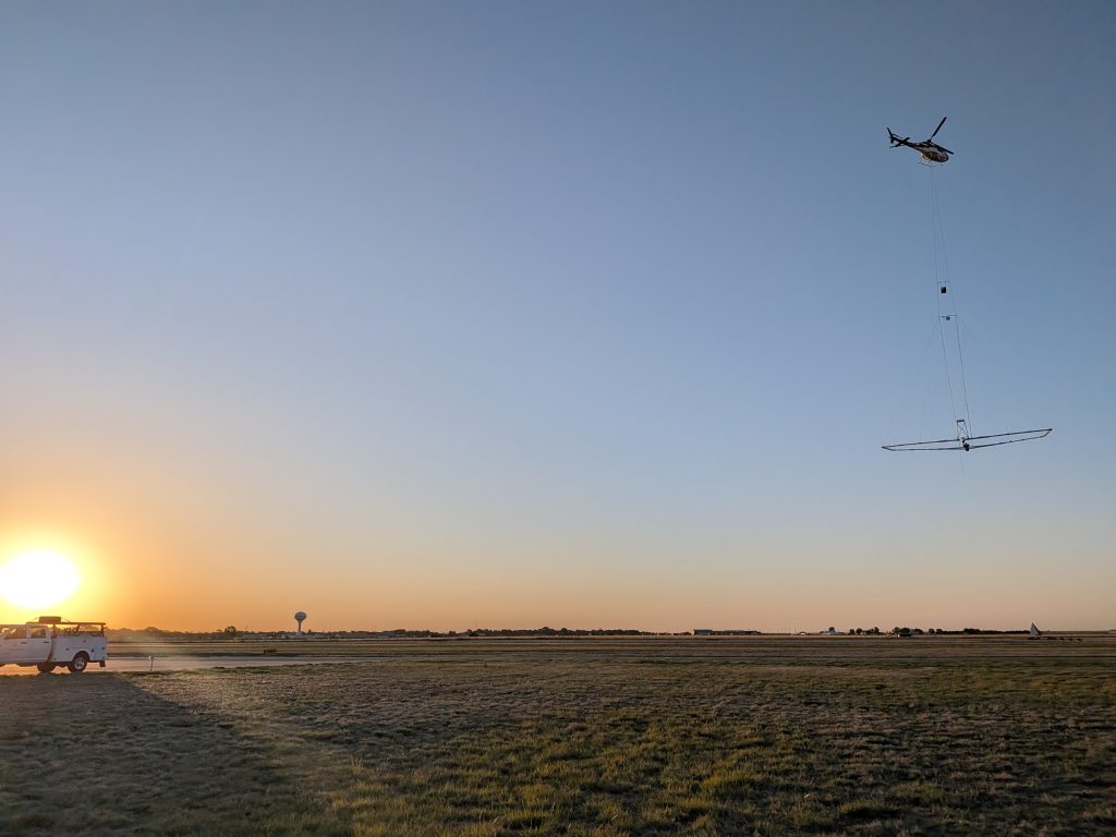
A helicopter towing a large hexagon frame 100 feet above the ground is something you don’t see every day in southwest Kansas.
Groundwater Management District 3 and the Kansas Geological Survey, partnered with Aqua Geo Frameworks LLC of Fort Laramie, Wyoming, and took to the skies for an airborne electromagnetic survey of Ogallala Aquifer in southwest Kansas. Aircraft got off the ground in late May. Partners seek to gather more data to better understand the aquifer conditions underground. The project is expected to be completed by July 31.
Aquifer stats
Project lead, Jim Butler of the Kansas Geological Survey, said in western Kansas, the biggest concern for many living in the area and those involved in agriculture, is the status of the aquifer.
“Just like in the other states that overlay the aquifer, it has been heavily pumped for decades (because) of irrigated agriculture and that intensive use has come at a price in terms of aquifer conditions,” Butler said. “There are portions of the aquifer in Kansas where we as kind of the general community drawing it down by 60-plus percent, in terms of the original aquifer thickness, before the onset of widespread pumping for irrigated agriculture.”
Sixty percent of the aquifer is gone, and that’s concerning. Butler said people look to KGS to see what the future holds.
“Our interest is to try to get a better picture of what that future might be, and to do that we need data,” he said. “We’re very fortunate in Kansas—I’m going to make a bold statement here—we have, and this is defensible, the best data on water quantity in the United States and beyond.”
That’s because every non-domestic well in the High Plains Aquifer of Kansas has a totalizing flow meter, and the producers are required to report usage annually.
“It’s subject to regulatory verification with some stiff penalties of folks who are fooling around with it,” Butler said. “We have a good feel for how much is pumped out. We also have a network of about 1,400 wells across the aquifer that we measure water levels in those wells every January.”
KGS has a good idea of how much water is being taken out and how that affects the aquifer.
“We’ve developed some approaches, so that we can take that data and tell producers, if they’re in a certain area, if you reduce pumping by a certain percent, this is going to be the impact on the water level decline rate, and under certain conditions the water levels could stabilize for the next decade or two,” he said. “We can tell them that with confidence.”
That’s because of a method called Q Stable that has a qualifier. It can be applied to an area 100 square miles or larger with an estimate that can be applied for the next couple of decades. A landowner or producer might want to know about what’s going to happen on a parcel of land.
“We’re just not able to use that technique to get finer spatial estimates of what the future holds, and obviously they want to go 30, 40, 50 years into the future,” Butler said.
It all boils down to better data on what he calls the “innards of the aquifer.”
“We’ve got a lot of wells that have been drilled, but you know what’s happening between the wells is a big question mark, and there’s a huge area that is involved there,” he said. “This airborne electromagnetic survey is directed at getting us data, basically on the large-scale aquifer structure, in terms of the units that readily yield water to the wells.”
The data from the survey will allow the groundwater districts to make better informed decisions.
Groundwater management
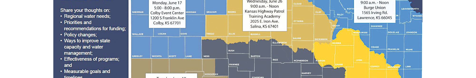
GMD 3 Manager Jason Norquest said similar surveys have been conducted in northwest and west-central Kansas during the last two years. A project like this has been at the conversation level for many years. GMD 3 spans all or parts of Hamilton, Kearny, Finney, Gray, Ford, Stanton, Grant, Haskell, Morton, Stevens, Seward and Meade counties.
“But as always, the funding was the problem, and we’re very grateful the state came through with some funding in the last few years to do this thing,” he said.
GMD 4 in northwest Kansas had a similar airborne electromagnetic survey which covered 2,500 miles in 2024 and 2,900 miles of western Kansas GMD 1 was surveyed in 2025. The project receives funding from the Governor’s Office, Kansas Legislature, and Kansas Water Office.
“The funding came through, and actually they added a little more money to us so we can get the whole district done, and get us better information,” he said.
Norquest said Kansas has some of the best data around.
“Between the driller’s logs, the pumping records, water use reports, everything. We have some of the best water information out there for Kansas,” he said. “But there’s always ways to fine tune it, and this is giving us capabilities to give us a more, almost a look to see if we’re on track with the calculations from other models we’ve run or is there a difference.”
GMD 3’s survey is going a little bit deeper than what has been done in the past because of the deeper formations.
“We’re hoping to possibly get a better understanding of the Dakota formations and stuff like that,” he said.
Once they get the completed data from this year’s survey, Norquest expects it to help with their strategies going forward
“We’ve seen declines for years on our end here, because the main problem is we’re over appropriated, and we are in charge of controlling that decline, or trying to stabilize it,” he said. “This is going to give us the data, help kind of manage that, because when we start putting in possible restrictions, it’s going to help us.”
Norquest said any restrictions that could be put in place might have effects on the agricultural economy, local and state economies, too.
Technology
According to the KGS, scientific equipment will hang 100 feet below the helicopter as it flies approximately 200 feet above ground on preplanned transects. The equipment is designed to map geologic structures that impact groundwater flow to depths of 1,600 feet below land surface.
The helicopter will be flown at about 50 miles per hour by pilots trained for low-level flying and experienced with airborne electromagnetic surveys. Flights will not occur over residential areas and other buildings, livestock feeding operations or wind turbines.
Jared Abraham, of Aqua Geo Frameworks, said the technology uses induced electromagnetic fields. He said the concept can be compared to cordless chargers for cell phones.
“You’re inducing a current in something without having to touch it and so why that’s important is we’re flying,” Abraham said. “We don’t have to be in direct contact with the ground.”
That’s called EM induction and he said similar to an extremely sensitive metal detector.
“It’s bigger, and it sees deeper, and what we do is we induce a current in wires around the loop, and then we shut that current off,” he said. “When we shut that current off in the loop, like disconnecting a battery, we have a generator, so we turn off the generator, and that causes the field to collapse, and that field collapse induces currents in the earth, and those currents in the earth diffuse out.”
This happens in milliseconds, and as they move away from the central point, it’s like a smoke ring and a diffusion rate—or how fast they move.
“Think about a smoke ring, someone blows it, it’s small and it gets bigger and bigger, same things happening in the earth,” he said. “That is controlled by the electrical resistivity of the earth materials.”
When mapping aquifers, they want to find sands and gravels. Those are separated by silts and clays, which are non-aquifers or aquacludes.
“By knowing the arrangement of the aquifer materials versus non-aquifer materials, we get a 3D distribution of the aquifer properties,” he said. “We’re going along mapping all these current changes and with time we solve for resistivity with depth and that’s in a numerical inversion process. Then we convert those resistivities to lithologies, or rock types, or aquifer materials.”
Abraham said for many years in the oil industry and in geotechnical and environmental applications like groundwater, technicians measured down boreholes called geophysical measurements.
“You can get insight on what you’re drilling through by measuring the electrical resistivity,” he said. “In the oil industry, oil is resistive. It’s an insulator. Salt water is not. Clay is conductive, so you can get information on what materials are made of.”
An aquifer of fresh water will be resistive while clays or shales will be conductive, and the same applies to salt water.
Abraham said they fly with the hexagon to save time.
“The system is about 100 feet below the helicopter, and it flies about 100 feet off the surface of the earth, and we’re measuring 10 times a second, and the field strengths are super low,” he said. “It’s like having a toaster oven on in your kitchen. It’s just a short pulse, and it’s amazing, the physics of the earth. We can even sense these things, because they’re such small signals.”
They do have to stay away from metal objects—pipelines, railroads, power lines, and other structures—because it corrupts the data.
“When we fly over those, we have to remove the data, because all we see is the man-made object and not the earth, which is a much lower magnitude signal,” he said. “We’re flying 50 to 55 miles an hour, and we can fly over the earth in most places. We avoid hitting trees and power lines and towers, but one thing we can’t do is we can’t fly over houses or confined feeding operations or anything like that.”
Pre-planning is essential, he said. Flight planning helps the researchers and Abraham connect the dots between bore holes or control points.
“KGS has an amazing water level measuring network and a very good borehole system, where they register boreholes, so in putting all that together, what we’re doing is we’re getting a data point about every 100 feet,” he said.
The technique gives a 3D image and going from a map view to 3D can help answer those more difficult questions—water conservation, water supply, water recharge, water sustainability, aquifer configuration—all these complicated questions require more sophisticated data, he said.
“The earth is very 3D, and as humans, that’s not always easy for us to conceptualize. We talk about cross sections or maps, but it’s very 3D,” he said. “The aquifers here in southwestern Kansas are very discreet, and you may have a paleo channel in this spot, and you go a quarter of a section farther, and nothing.”
Aquifers can be discreet, and the depletion has occurred over time, and farmers can notice changes in their production. It can also help those in charge of water regulations.
“It changes about what place in the aquifer you’re pulling from, and so they’re seeing changes in their yield and saturated thickness,” he said. “It’s helping to empower the elected boards and the people that have to make those decisions and help them communicate to the producers and the constituents.”
By illuminating how the changes are happening, Abraham said the discussion can turn to how the problems can be solved.
“Information is empowering and that’s what this whole process is about, is empowering, making better decisions, and understanding the natural world,” he said.
Kylene Scott can be reached at 620-227-1804 or [email protected].