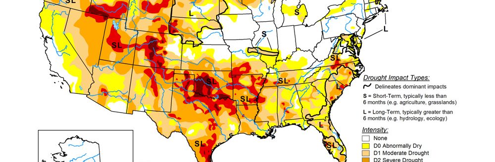
Wet fall is the story of the Southwest
The very wet fall continued across the southwest quarter of the contiguous United States to end October.
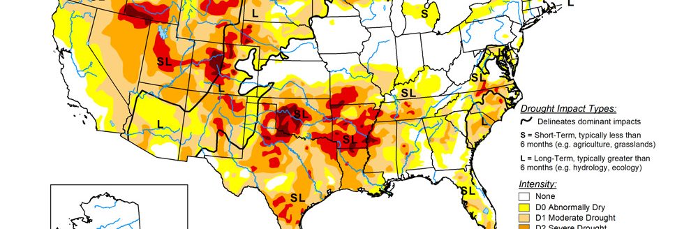
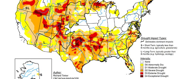
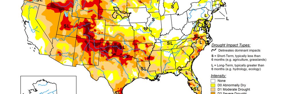
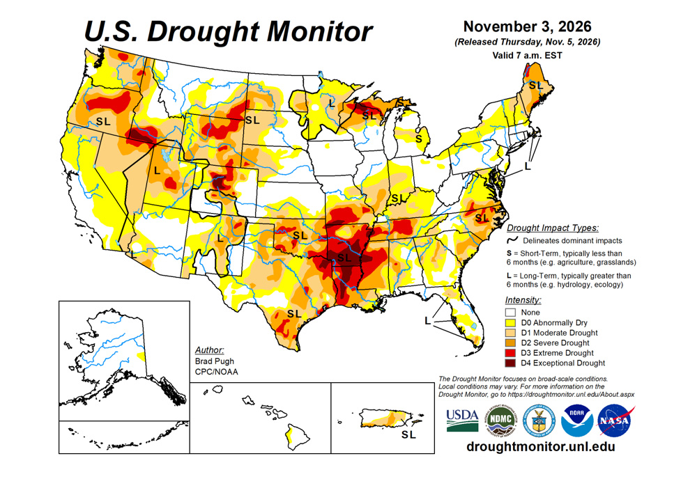
Based on the additional heavy precipitation (more than 1 inch) from Oct. 27 to Nov. 2 and a positive shift in the long-term metrics since September, a broad 1-category improvement was made to the Southwest and Great Basin. Although short-term drought has ended, lingering long-term drought remains designated for parts of these areas.
The remnants of Hurricane Vance from the East Pacific brought drought-improving precipitation to western and central Texas. At the start of November, heavy precipitation prompted improvements to the Great Plains and Upper Mississippi Valley.
Drought coverage continued its late summer and fall decline across Florida. Drought expanded and intensified for parts of the Lower to Middle Mississippi Valley, Ohio Valley, Mid-Atlantic, and New England.
The U.S. Drought Monitor is jointly produced by the National Drought Mitigation Center at the University of Nebraska-Lincoln, the U.S. Department of Agriculture and the National Oceanic Atmospheric Administration. (Map courtesy of NDMC.)
South
The remnants of Hurricane Vance in the East Pacific brought heavy rainfall to western and central Texas.
A 1-category improvement was made roughly to areas that received more than 1 to 1.5 inches of rainfall. Also, the standardized precipitation index at various time scales were considered. The unusually wet fall continued in New Mexico where a broad 1-category improvement was necessary.
Additional improvements may be needed in subsequent weeks to be more consistent with long-term metrics. The short-term drought has ended for New Mexico. Near or more than 1 inch of precipitation supported improvements across the western third of Oklahoma. Since this precipitation occurred on Nov. 2, additional improvements may be made to a greater coverage of Oklahoma next week once a full assessment of the latest metrics is completed.
The severe drought, extreme drought and exceptional drought coverage across Arkansas, Louisiana, Mississippi, and Tennessee is generally consistent with standardized precipitation evapotranspiration index at various time scales and soil moisture indicators.
Midwest
Widespread D2 to D3 continues across southern Missouri and 60 to 90-day SPEI along with soil moisture supported an expansion of those drought categories in the southern third of the state. Increasing 30 to 60-day precipitation deficits, declining soil moisture, and the NDMC short-term blend resulted in a 1-category degradation across Illinois, and Missouri. Conversely, unusually heavy precipitation (widespread amounts of 1.5 inches+) for this time of year led to a broad 1-category improvement for much of Minnesota. The short-term drought has ended for nearly all of Minnesota.
High Plains
Widespread precipitation (0.5 to 2 inches, locally more) resulted in 1-category improvements to the western third Colorado along with parts of the Northern to Central Great Plains.
Recent precipitation and the “convergence of evidence” supported discontinuing the D3 in most of the Nebraska Panhandle.
West
A low-pressure system at an unusually low latitude for this time of year resulted in anomalously wet conditions across the Desert Southwest over Halloween weekend.
The short-term drought has ended for the Southwest and Great Basin. Despite multiple short-term metrics on the wet side, long-term drought of varying intensity persists across parts of these areas.
Precipitation (0.5 to 1 inch, locally more) this past week led to small improvements for parts of Montana.
Looking ahead
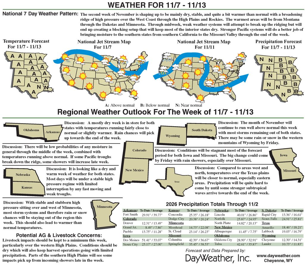
A much drier multi-day period (Nov. 5 to 9) and more typical for fall is forecast for a majority of the lower 48 states. A cold front will trigger a period of wet weather along the East Coast with the heaviest amounts (more than one inch) from the coastal Mid-Atlantic north to southeastern New England. Along the tail end of this front, heavy precipitation may occur across the Lower Rio Grande Valley. The only other area forecast to receive significant precipitation is the coastal Pacific Northwest.
By mid-November, there is an increasing chance that an atmospheric river affects the West Coast. The National Weather Service’s 6- to 10-day outlook (valid Nov 10-14) depicts more than a 60 percent chance of above-normal precipitation for much of California and the Pacific Northwest.
Above-normal precipitation is also favored across the Great Basin and Southwest. Below-normal precipitation is more likely across the northern to central Great Plains and Midwest. The enhanced Pacific flow strongly favors above-normal temperatures for nearly all the contiguous U.S., which is typical for a strong El Nino during the fall.
Brad Pugh is with CPC/NOAA.