Cooler than normal conditions in Midwest, High Plains
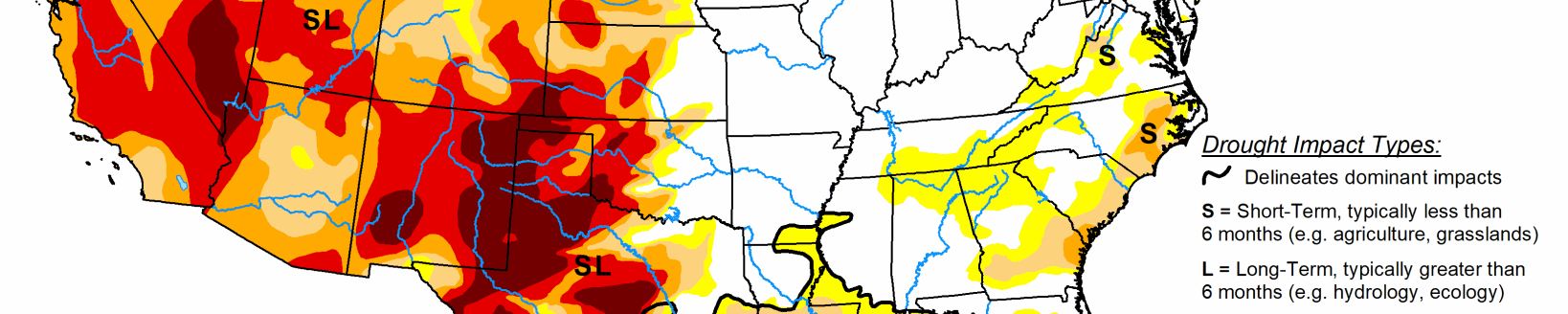
The southern Plains, Mississippi Valley, Pacific coast and south Florida were the recipients of the greatest rains this week, with some areas of Louisiana and south Florida recording 5+ inches of rain for the week. Dryness over the East and West was also coupled with warmer than normal temperatures over the West. Temperatures were 3-6 degrees above normal over the Nevada, Utah, Colorado and New Mexico regions while the northern Plains was 6-9 degrees below normal. Many dry areas of the Plains and Midwest have not had drought development due to the unseasonably cool temperatures in May.
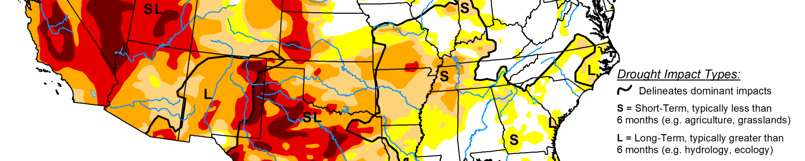
Midwest
Cooler than normal conditions again dominated the region with temperatures 2-4 degrees below normal in the southern portions of the area and 4-6 degrees below normal in the north. A slow-moving storm system affected the eastern areas of the region, with many areas recording 2-3 inches of rain with locally greater amounts. There are several dry pockets in the region, and areas of Wisconsin, Minnesota and northeast Iowa all had abnormally dry conditions expand this week due to the dryness over the short-term. Abnormally dry conditions were also expanded over southeast Iowa and into northwest Missouri. The lack of above-normal temperatures has kept drought from developing, but conditions are being monitored.
High Plains
Temperatures over the region were generally 6-8 degrees below normal, with portions of Colorado and Wyoming the outliers with temperatures 2-4 degrees above normal. Most of the region was fairly dry for the week with many areas below normal for precipitation during one of the wettest months of the year. Portions of western South Dakota, western Nebraska, northeast Colorado, and southeast Kansas did record precipitation that was well above normal with 150-400 percent of normal for the week.
With the dryness throughout much of the area, abnormally dry conditions were expanded and moderate drought was introduced to portions of western North Dakota and into South Dakota. Abnormally dry conditions were expanded through central and southeast Nebraska and portions of northeast Kansas. These areas will be ripe for drought development without rain, especially if temperatures become more seasonable. Northeast Colorado did see some improvement due to recent heavy rains as the severe and moderate drought as well as the abnormally dry conditions shifted south slightly. The abnormally dry pocket in southeast South Dakota was also removed this week after some locally heavy rain.
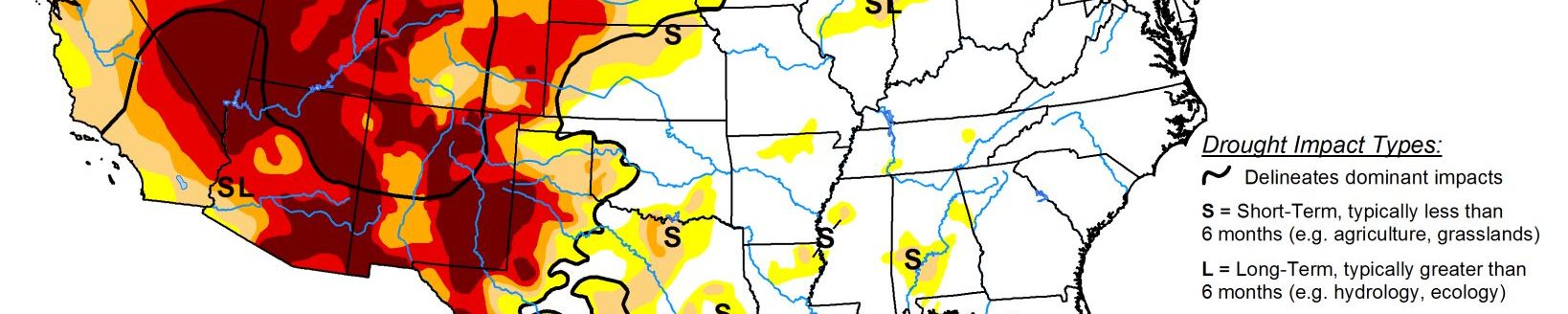
South
Temperatures over the region were near normal to slightly below normal where the most precipitation took place. Areas of west Texas were 3-6 degrees above normal for the week. It was an active week over much of the region for precipitation, which allowed for improvements over much of the area. Most of southern, central, and eastern Texas as well as southern Louisiana had a full category improvement as these areas recorded the greatest precipitation, which shifted the drought indices, allowing improvement to take place. Some areas of southern Louisiana had 10+ inches of radar-estimated rainfall.
Areas of the Texas and Oklahoma panhandles, west Texas, and southwest Oklahoma did not receive any of this rain and conditions continued to deteriorate. Portions of western Oklahoma have had all winter wheat zeroed out as producers did not get a crop to grow and did not even see enough growth for grazing purposes. In southwest Oklahoma, moderate drought and abnormally dry conditions expanded this week. Some areas of the Texas panhandle did see improvements to the abnormally dry conditions while other areas missed out on the rain and saw conditions decline. Abnormally dry conditions were also expanded over west Texas this week.
West
Most of the region was dry for the week with the exception of the Pacific Northwest and northern California, where 150-200 percent of normal precipitation was recorded. Temperatures for the region were 3-6 degrees above normal over central Nevada, Utah, Colorado, and eastern New Mexico, with most of the rest of the region near normal to 3 degrees below normal for the week. In the Pacific Northwest, the recent rains helped to slow down further degradation in Oregon and Washington, with portions of the abnormally dry areas of western Washington improved this week. Oregon has some improvement to the severe and extreme drought over the southwest portions of the state but did see moderate drought expand slightly over portions of the western areas of the state. Conditions in Nevada and Utah continue to decline with an intensification of moderate and severe drought over northern portions of both states as the short-term dryness is starting to combine with the long-term issues in these areas.
New Mexico had an expansion of moderate, severe, and extreme drought in the northern portions of the state as some of the recent dryness is coupled with longer-term issues in the drought indicators. Abnormally dry conditions were expanded over most of eastern New Mexico as a result of short-term issues. Southwest Colorado had an expansion of extreme and severe drought conditions while moderate drought was expanded northward over the central portion of the state.
Related Articles