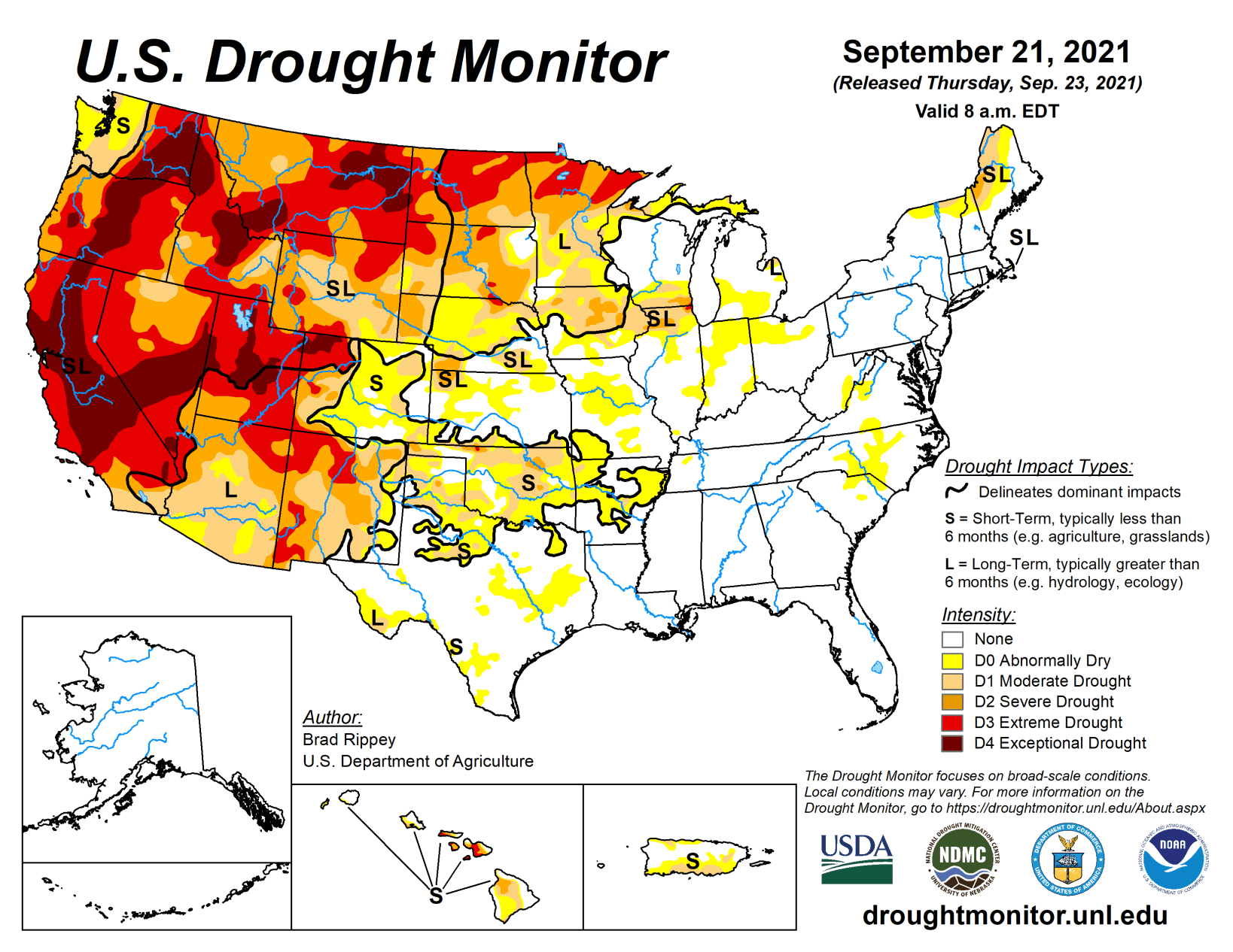
For much of the drought-monitoring period, the remnants of Hurricane Nicholas continued to produce heavy showers across the South. Toward the end of the period, residual tropical moisture was drawn northward in advance of a strong cold front, further enhancing rainfall in several areas. At the Tuesday morning (Sept. 21) cutoff, rain was falling in several areas—including parts of the Midwest—that have been experiencing dryness or drought.
Meanwhile, the Northwest also received some precipitation, including high-elevation snow, providing limited drought relief. In many sections of the country, however, dry weather favored summer crop maturation and harvesting, but reduced topsoil moisture for newly planted winter grains. Some of the most significant short-term dryness, aggravated by late-season heat, existed across the southern Plains.
South
The region remained a contrast between wetness in areas affected by the remnants of Hurricane Nicholas (and previous tropical systems) and rapidly developing dryness (D0) and moderate to extreme drought (D1 to D3) in Arkansas, Oklahoma, and Texas. According to the U.S. Department of Agriculture, topsoil moisture rated very short to short increased at least 10 percentage points during the week ending September 19 to reach 72% in Oklahoma and 69% in Texas.
Broad deterioration of up to one category was observed across the driest areas. One of the driest spots was Tulsa, Oklahoma, where August rainfall totaled 0.78 inch (23% of normal) and Sept. 1-21 precipitation stood at one-tenth of an inch (4% of normal). Tulsa also reported high temperatures of 90°F or greater on each of the last 26 days of August and first 20 days of September, but the 46-day streak finally ended with a high of 80°F on September 21. By September 19, USDA reported that winter wheat was 20% planted in Texas and 15% planted in Oklahoma; that crop will soon need rain to ensure germination and proper establishment.
Midwest
Hefty rains fell across some of the region’s hardest-hit drought areas in Minnesota and environs, resulting in improvements of up to one category in the drought depiction. For example, northern Minnesota’s area of exceptional drought (D4) was eliminated by well-placed rainfall. On Sept. 20, International Falls, Minnesota, received more than 2 inches of rain in a calendar day for the first time since July 17, 2019. According to the U.S. Department of Agriculture, Minnesota’s topsoil moisture rated very short to short has dramatically improved in recent weeks, from 84 to 35% between Aug. 15 and Sept. 19. Upper Midwestern rain arrived too late to benefit drought-affected summer crops; on Sept. 19, roughly one-quarter of Minnesota’s primary row crops—26% of the corn and 25% of the soybeans—were rated in very poor to poor condition, with harvest underway. Farther south, however, not all areas received rain through the end of the drought-monitoring period. As a result, dryness and drought intensified in some locations, including parts of Missouri, northern Illinois, southern Wisconsin, and the lower Great Lakes region. On September 19, USDA noted that topsoil moisture was at least one-half very short to short in Indiana and Ohio.
High Plains
Heavy rain clipped some eastern sections of the region, but many areas were dry, or nearly so, during the drought-monitoring period. A surge of heat in advance of a cold front, peaking on Sept. 18, resulted in unusually high temperatures, followed by cooler conditions. On the 18th, there was a flurry of daily-record highs, including 98°F in Chadron, Nebraska; and 96°F in Dickinson, North Dakota.
Still, drought conditions in many parts of the High Plains have modestly improved in recent weeks. Due to that beneficial rain, exceptional drought (D4) was removed from central North Dakota. A few other areas also noted drought improvements of up to one category, as moisture has generally increased for newly planted winter wheat—and some pastureland has begun to respond. Even with the rain, the U.S. Department of Agriculture reported that on Sept. 19, topsoil moisture across the region ranged from 41% very short to short in Nebraska to 88% in Wyoming. Some rangeland and pastures continue to reel from drought that appears to have peaked earlier in the year; on September 19, the Dakotas led the region in very poor to poor ratings—83% in North Dakota and 80% in South Dakota. Wyoming’s rangeland and pastures were rated 71% very poor to poor.
West
Any meaningful precipitation was confined to the northern Rockies and the Pacific Northwest, resulting in modest improvement in the drought depiction for those areas. As colder air arrived on Sept. 19, precipitation changed to snow in Yellowstone National Park and other high-elevation sites in the northern Rockies and Northwest. In Oregon, record-setting rainfall totals for Sept. 18 reached 1.31 inches in Portland and 1.13 inches in Salem. With a 0.42-inch sum, Spokane, Washington, also collected a record-setting total for September 18. Portland’s 3-day (Sept. 17-19) rainfall reached 2.52 inches. However, Washington’s topsoil moisture, as reported by the U.S. Department of Agriculture, improved only from 100 to 90% very short to short during the week ending Sept. 19. The precipitation had little impact east of the northern Rockies; Montana led the nation on the 19th with topsoil moisture rated 95% very short to short.
Meanwhile, producers along and northwest of a line from California to Wyoming continued to deal with abysmal rangeland and pasture conditions, which (as reported by USDA) ranged from 55% very poor to poor in Idaho to 91% in Montana and Washington. Farther south, the 2021 North American monsoon has withdrawn from the Southwest, roughly on schedule, following a summer of beneficial rainfall that provided relief from short-term drought but left significant, underlying long-term drought issues such as groundwater depletion and low reservoir levels.
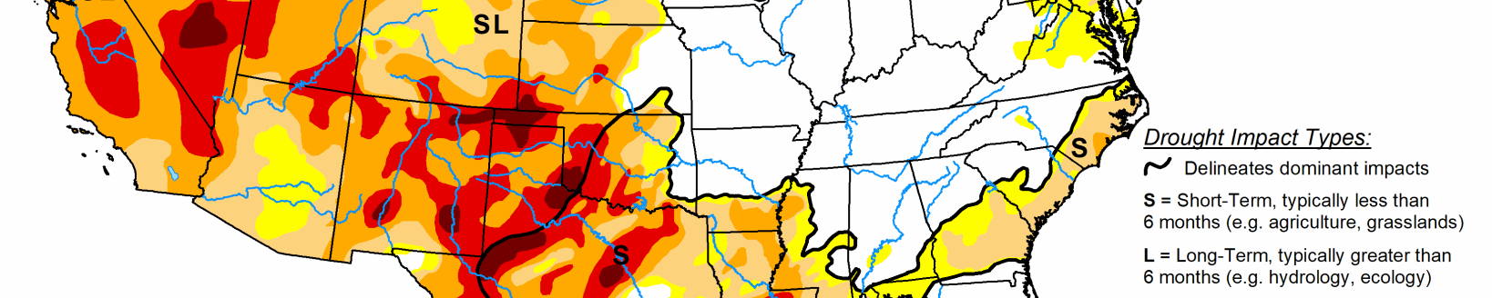
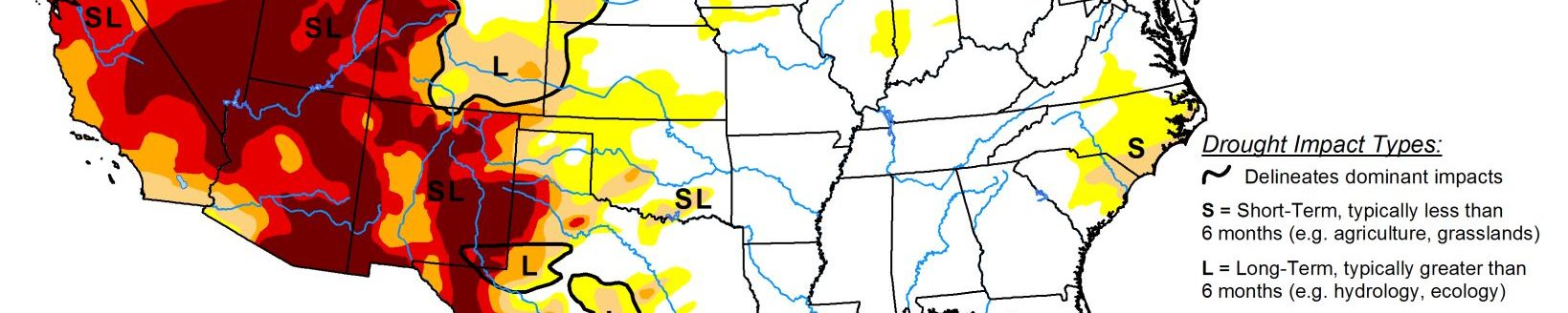
Areas that received substantial monsoon-related rainfall are designated on the map with an “L” label, indicating that long-term drought persists. Elsewhere, several wildfires continued to actively burn, especially in parts of California. The latest “hot spot” for wildfire activity was the southern Sierra Nevada, where the Windy Fire and the KNP Complex were the most significant incidents. The KNP Complex, a 28,000-acre, lightning-sparked fire, was burning in California’s Sequoia National Park. The Windy Fire, which has charred more than 31,000 acres of vegetation and was also igniting by lightning, was burning in several jurisdictions, including the Tule River Indian Reservation and the Sequoia National Forest.
Related Articles