Cooler weather and moisture story of past week
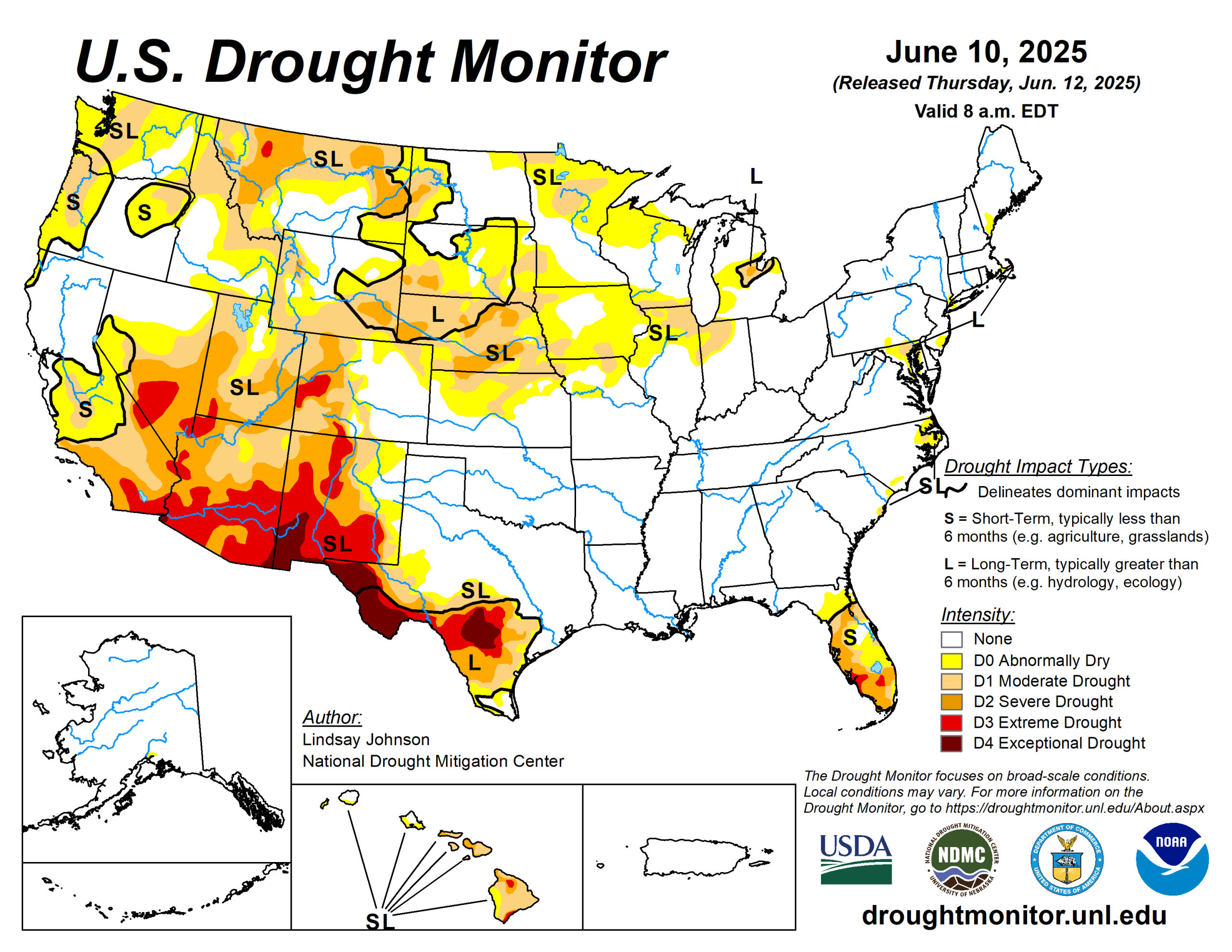
This past week brought sharp weather contrasts across the United States. The central Plains were 5 to 10 degrees Fahrenheit cooler than normal, while the Pacific Northwest was 5 to 10 degrees warmer than average.
A broad stretch from Texas through the Midwest to the Northeast received well above-normal rainfall, helping to ease drought conditions, while much of the West, northern High Plains and Florida remained dry, with many areas receiving just 5 to 25 percent of normal precipitation.
These patterns led to widespread drought improvements across the High Plains, Midwest, South, and Northeast, particularly from northern Texas to southern Illinois, where 1 to 3 inches of rain reduced short-term dryness. Kansas, Nebraska and eastern Colorado saw significant gains, but drought worsened in north-central Kansas, northwestern Colorado, and western Wyoming. Southwestern South Dakota and eastern Wyoming also improved. In the Midwest, drought eased in Missouri, but degraded in northern Minnesota and eastern Iowa.
New Mexico saw minor improvements in the southeast but stayed dry elsewhere. In the West, drought continued to worsen in Montana and southeastern Wyoming due to ongoing dryness and low snowpack. Conditions in the Northwest are quickly degrading with well below-normal precipitation.
The U.S. Drought Monitor is jointly produced by the National Drought Mitigation Center at the University of Nebraska-Lincoln, U.S. Department of Agriculture and National Oceanic Atmospheric Administration. (Map courtesy of NDMC.)
South
In the South, especially in Texas and Oklahoma, heavy rain led to drought improvements in many areas. Northern and central Texas saw improvements, while southern and western Texas only received enough precipitation to lead to one-category improvements along the border of the drought area.
Oklahoma received a lot of rain and showed clear signs of recovery. Other southern states, like Arkansas, conditions continue to be stable.
Midwest
The Midwest experienced a mix of drought improvements and degradations, largely driven by the heaviest rainfall. A broad band of rain stretched from Missouri through Illinois, Indiana, and into parts of Michigan, bringing widespread one-category improvements.
This rainfall helped ease short-term drought conditions, replenish surface moisture, and support crop and soil health. Missouri saw particularly broad improvements, with steady precipitation over the past one to two weeks. In Minnesota, the situation was more mixed: the central and southern parts received enough rain for some improvement, but the north and northeast remained dry, leading to worsening drought due to ongoing deficits and weak hydrologic indicators.
Iowa was also mixed—much of the central and western parts improved, but eastern Iowa missed most of the rain and saw the reintroduction of abnormally dry (D0) conditions. Overall, the region benefited from a well-timed wave of rainfall, though some northern and eastern areas continue to lag in drought recovery.
High Plains
The High Plains experienced a mix of drought improvements and degradations depending on rainfall. Kansas saw the most widespread improvements, especially in the southern and eastern regions, where many areas received more than 2 inches of rain, leading to significant one-category upgrades. However, north-central Kansas received less precipitation, and drought conditions there either persisted or worsened.
Nebraska also benefited from recent storms, with helpful rainfall improving conditions in the central and southeastern parts of the state, though some areas now show signs of short-term moisture surplus. Colorado had a similar split. While much of the central and eastern regions received beneficial rainfall and saw improvements, the northwestern and southwestern corners remained dry and experienced drought deterioration.
Wyoming followed an east–west divide as well: rain improved conditions in the central and eastern areas, but the west remained dry, resulting in further degradation. Long-term moisture deficits and below-average snowmelt runoff continue to be a concern across western parts of both Colorado and Wyoming.
In South Dakota, the southwest corner received 1 to 3 inches of rain, leading to localized improvement, while the rest of the state remained mostly unchanged.
West
The West saw a mix of drought relief and worsening conditions this past week, with the most notable improvements concentrated in the Southwest due to rare early June rainfall.
New Mexico’s southeastern areas saw some improvement from the same rainfall that led to improvements in Texas. Montana faced some of the worst conditions in the region. Dry weather and below-normal snowpack led to expanding drought across the northwest and central parts of the state, raising concerns as the region enters the warmest part of the year with limited water reserves.
Looking ahead
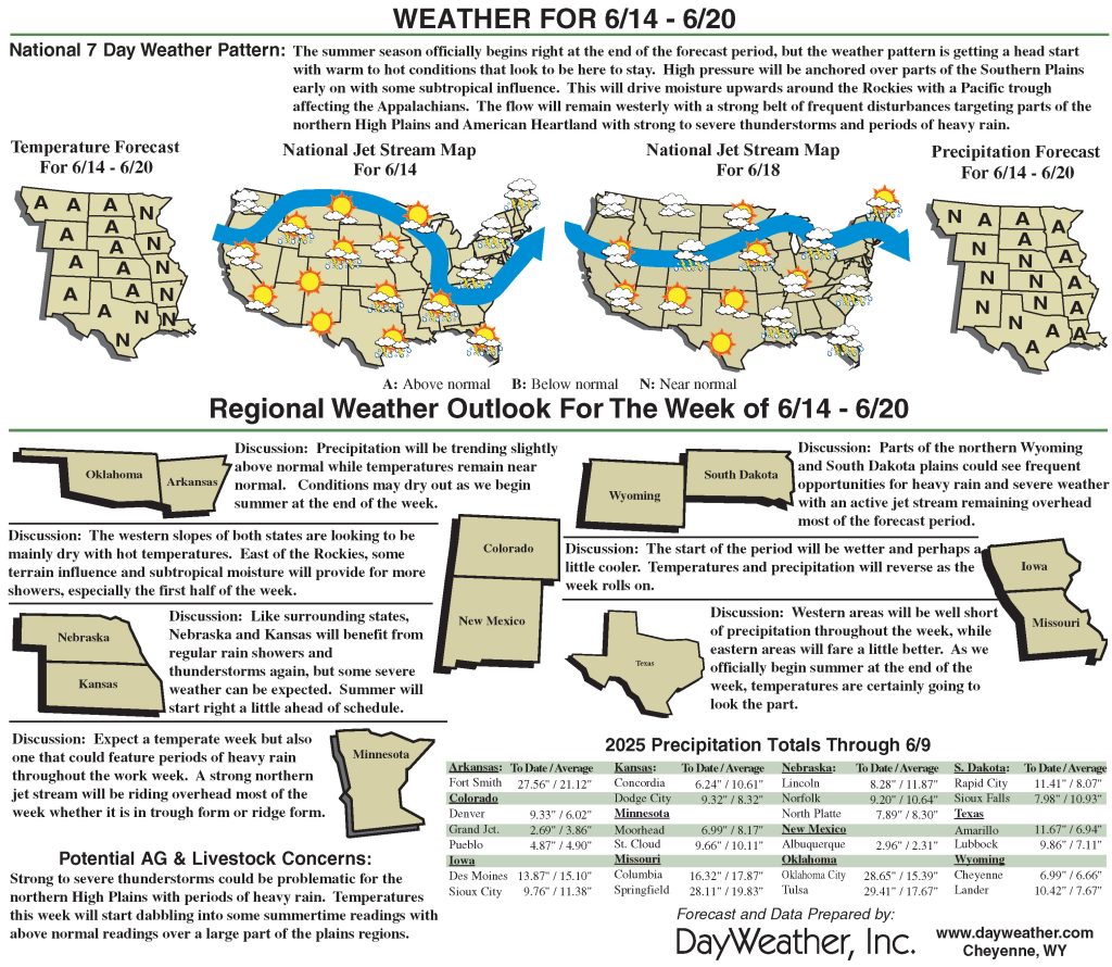
Over the next five to seven days, heavy precipitation is expected across several regions. Eastern Texas, southeastern Oklahoma, and Arkansas will experience significant rainfall. The northern Midwest and High Plains are also expected to receive moderate rainfall, with 2 to 4 inches expected in parts of northern Minnesota and northeastern Iowa. Nebraska is forecasted to see above-normal precipitation.
Meanwhile, the West Coast will miss out on significant rain, with little to no precipitation expected from Washington down through eastern Colorado and New Mexico.
The six- to 10-day outlook shows above-normal temperatures are expected across the rest of the lower 48 states. The greatest chances for above-normal temperatures are in Colorado and southern Wyoming. Above-normal precipitation is more likely in the northern High Plains, upper Midwest and southern Texas. Much of the West is expected to have near- or below-normal precipitation, with the greatest likelihood of below-normal precipitation extending from southeastern Oregon to the Four Corners region.
Lindsay Johnson is with the National Drought Mitigation Center.
Related Articles


