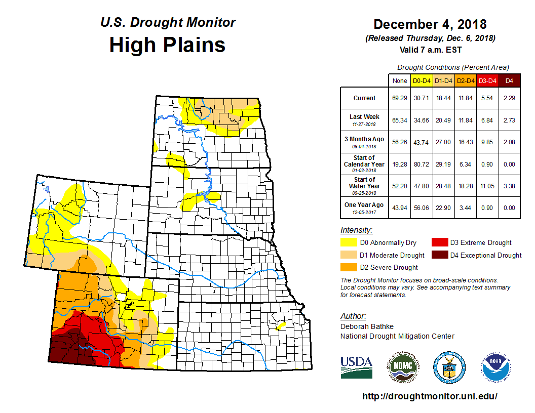
According to the U.S. Drought Monitor for Dec. 4 released Dec. 6, a storm impacted much of the continental United States. The storm delivered heavy rain and mountain snow to the West, snow and wind to parts of the Plains and upper Midwest, and severe weather and tornadoes to the mid-Mississippi valley and Southeast coast.
In the High Plains, moderate to heavy precipitation from a weekend storm, in the forms of rain and wind driven snow, fell roughly from the western reaches of the Dakotas to the northern half of Kansas. The precipitation allowed for the removal of moderate drought in east-central Kansas. While last week’s snowfall in the Dakotas was near normal for this time of year, long-term precipitation deficits have shown recovery, resulting in the removal of moderate drought in South Dakota and reductions in North Dakota. Moderate drought and abnormal dryness remain in those areas still experiencing low groundwater levels, soil moisture shortages, and long-term precipitation deficits.
This week’s storm brought a mix of weather to the Midwest including rain, snow, and severe thunderstorms. The precipitation helped alleviate some of the lingering pockets abnormal dryness in Minnesota and Missouri.
Rainfall from this weekend’s storm affected parts of eastern Oklahoma, Arkansas, Mississippi, Tennessee, and Louisiana, which allowed for a slight reduction in moderate drought in northeast Oklahoma and northwest Arkansas. Other than this moderate drought area, no other changes to drought were made, and the region remained drought free with the exception of the Texas Panhandle and northeast Oklahoma.


