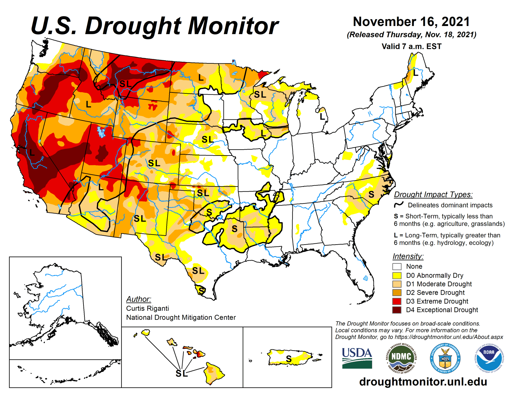
Drier weather in the southwestern United States, western Great Plains, and Southeast led to drought conditions developing or worsening for parts of these regions this week. The northern Great Plains, western Great Lakes, the Northeast, and the Pacific Northwest saw significant precipitation this week, which led to improving drought conditions in parts of these regions.
Slightly warmer than normal weather occurred in the Northeast, and warmer weather also occurred west of the Mississippi River. The warmest temperatures, compared to normal, were found in the northwestern Great Plains and in the West, with some areas seeing temperatures at least 6 degrees above normal.
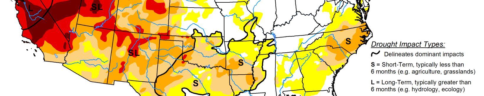
South
In the South this week, rain fell primarily to the east of Interstate 35 in Texas and Oklahoma, and in Arkansas, northwest Louisiana, and parts of Tennessee. Overall, though, the week was somewhat dry across the region. Along and west of I-35 in Texas and Oklahoma, temperatures generally ranged from 2 to 6 degrees above normal, and some areas locally reached 8 degrees above normal. East of there, temperatures were either near normal or slightly cooler than normal. In Texas and the Oklahoma Panhandle, drought conditions largely stayed the same or worsened, due to mounting short-term precipitation deficits, decreasing streamflow in some locations, high evaporative demand, and decreasing soil moisture in some areas.
Moderate short-term drought also expanded in coverage in northern Louisiana, western Mississippi, western Tennessee, and southern Arkansas this week, where short-term precipitation deficits worsened and soil moisture decreased. Drought conditions in Arkansas, Louisiana, Tennessee, and east Texas, along the Red River, and in deep south Texas, are mostly short-term. Other areas experiencing drought in the South have drought conditions on both the short- and long-term.
Midwest
Much of the Upper Midwest saw significant precipitation this week, which led to some improvements in drought conditions. The biggest winners for precipitation totals were located from central Iowa to western Wisconsin and eastern Minnesota, where amounts of 1.5 to 2 inches were common. Temperatures in the Midwest region were relatively close to normal in most areas, though much of Missouri came in 2 to 4 degrees warmer than normal. The precipitation was sufficient to improve drought conditions in parts of Iowa, Wisconsin, and Minnesota. Additional drought condition improvements could occur in the Midwest next week after learning the effects of recent precipitation on soil moisture, streamflow, and other variables. A small area of central Wisconsin that missed out on heavier amounts saw its precipitation deficit grow, so moderate drought expanded there.
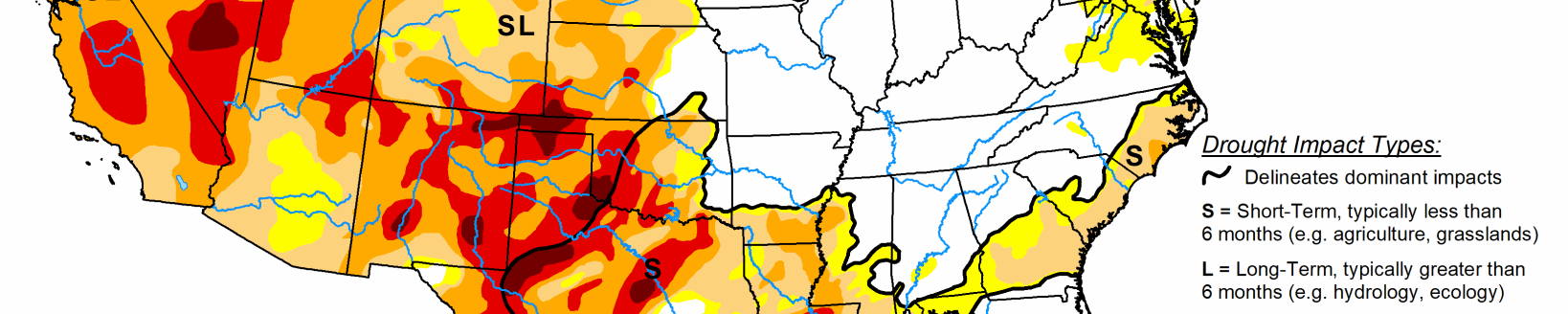
High Plains
The eastern edge of the High Plains region saw notable precipitation amounts this week, in particular the eastern parts of North Dakota and Kansas. Otherwise, largely dry weather ruled the week. Precipitation amounts were sufficient in northeast North Dakota to reduce long-term deficits enough to cause improvements in long-term drought. In eastern Colorado and western Kansas, drought worsened and expanded in some locations, as soil moisture continued to decrease and precipitation deficits on the short- and long-term continued to grow.
Most of the High Plains saw a warmer than normal week, with the warmest temperature anomalies (4 to 10 degrees above normal) taking place in western Nebraska and Kansas, the western Dakotas, and eastern Colorado and Wyoming. Residual effects from the now mostly long-term drought continued in the Dakotas, where livestock producers had problems feeding herds due to alfalfa and hay shortages.
West
Mostly warmer than normal weather occurred in the West region this week. Many parts of the region saw temperatures range from 4 to 8 degrees above normal. Significant precipitation mostly occurred in the northern Sierra Nevada and in western Montana, northern Idaho, and in Washington and Oregon. In western Washington and Oregon, precipitation totals of 2 to 6 inches, with locally higher amounts, were common. Improvements were made to drought conditions in Washington, Oregon, Idaho, and western Montana where long-term precipitation deficits, soil moisture, and groundwater were improved the most.
Conditions in south-central Wyoming and northwest Colorado also improved where short-term precipitation shortfalls had lessened and soil moisture had increased. In north-central Montana, short- and long-term precipitation deficits mounted and soil moisture and streamflow decreased, leading to the expansion of exceptional drought. In California, citrus crops have taken a hit as a result of the long-term drought conditions, and reservoirs continue to be very low.
Looking ahead
The Weather Prediction Center’s forecast (valid Nov. 17-24) shows a deep low pressure system over Canada affecting much of the central and eastern half of the Lower 48. The system’s warm front will bring a mix of snow, sleet, and freezing rain to the Northeast. Temperatures behind the front are expected to be up to 20 degrees above normal. The system’s cold front will push through the mid-section and eastern U.S. through Friday. It is expected to bring showers and thunderstorms to parts of the South and Southeast. Temperatures in the eastern half of the country are expected to drop 1 to 7 degrees below normal after the front passes. The cold air will set up lake-effect rain and snow showers over the Great Lakes. Meanwhile, a new storm system will affect the Pacific Northwest. This is expected to bring more rain and high elevation snow to the region. Temperatures across much of the West are expected to be 2 to 8 degrees above normal.
The Climate Prediction Center’s 8- to 10-day outlook (valid Nov. 24-30) favors below normal precipitation across much of the West and parts of the High Plains and Midwest. Above normal precipitation is favored from the eastern part of the Southwest along the Gulf Coast and into the Southeast. Above normal temperatures continue to be likely for the western U.S. Below normal temperatures are favored for much of the east.
Related Articles